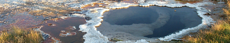
Lying at the base of Steens Mountain, along the western edge of the Alvord Desert, are the Alvord Hot Springs. These springs are linearly aligned along approximately 120 meters of the Alvord fault. Temperatures range from about 60° to 80°C (averaging ~75°C). At least 45 cooler springs lie south of Alvord Hot Springs along the Alvord fault (see maps to the right).
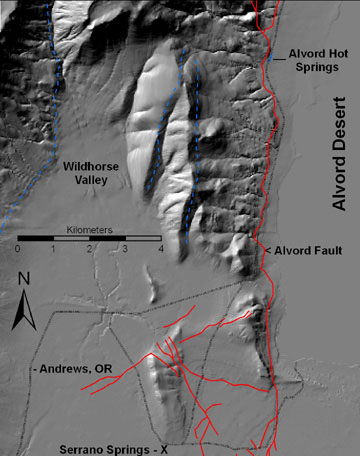 Hillshade map of western Alvord Basin showing location of Alvord Hot Springs and Quaternary faults (red - active during Holocene; blue - possibly active during Quaternary). Fault data from Walker and McLeod, 1991.
 |
|
To learn more about the datasets collected from Alvord Hot Springs, go to the Data Resources page. Terrestrial laser scanning has been done along the Alvord fault at Alvord Point (located in the southern portion of the maps below) in order to determine rates of deformation.
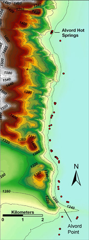 Shaded relief map showing Alvord Hot Springs and cooler springs to the south. Contour interval = 20 m.
 |
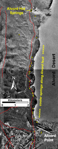
Digital orthophoto of Alvord Hot Springs area. Springs shown in yellow, faults in red.
|
|