Introduction
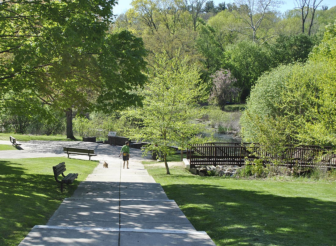
Saylor Grove stormwater park. Photo: Anna Boisnic, Philadelphia Water Dept.
Similar to a retention basin, stormwater wetlands collect runoff and stores it in a permanent pool. A design storm is defined and held permanently while larger storms exit through an outlet structure as in a detention basin. Therefore, the stormwater wetland can be designed to reduce the storm peak and volume but is also intended to improve the quality of water held in the wetland.
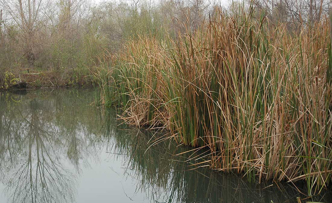
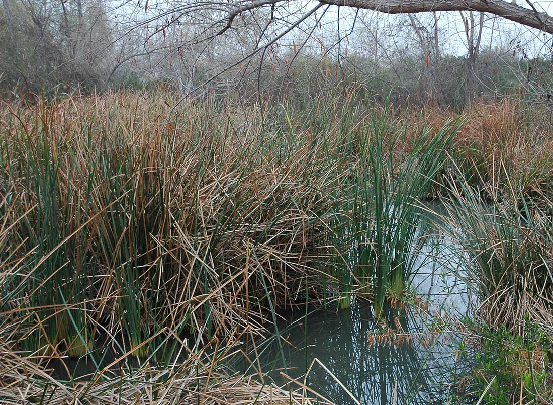
Stormwater wetlands are shallow (generally less than 3' deep) and filled with marsh vegetation that helps treat the water and encourage sediment and attached pollutants to settle to the bottom of the wetland.
Stormwater wetlands differ from naturally occurring wetlands fed by a stream and with constant inflow and outflow. This difference is important in the arid U. S. where infiltration and long dry summers cause all of the water in the wetland to be lost. This, of course, compromises the health of many wetland plants but some species are adapted to wet and dry cycles. Nevertheless, even in the West stormwater wetlands can be designed to perform both stormwater management and quality functions.
Because stormwater wetlands imitate the functions of natural wetlands, these systems can become aesthetic assets to the community and provide habitat for wildlife. The image above of the Saylor Grove stormwater park illustrate the compatibility of stormwater treatment and park recreation, aesthetics, and even, educational functions. Enlarge the image and find the interpretive panels in the wetland overlook.
Design
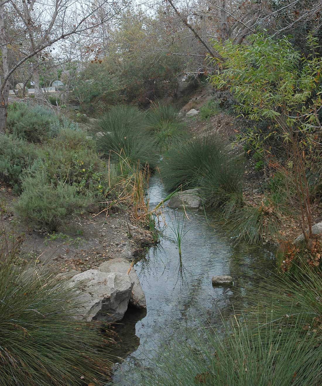
Chino Creek Wetland Park. Photo: Austin , 2014
Stormwater wetlands require more care in design than detentions basins since creating conditions suitable for the water needy plants is necessary. In this tutorial we will address the water management aspects of stormwater wetland primarily and reserve a discussion of the water quality benefits for a later section.
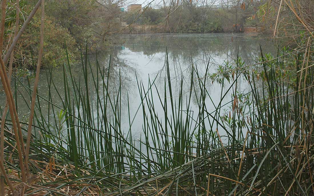
The depth of the wetland must be limited to about three feet in order to sustain rooted macrophytes, however, water can be deeper during after storms as with detention basins. In fact, the depth of the water in the basin should vary from shallow (6" deep) to more 4' or deeper in a few sections to encourage a full range of plants and other organisms and to distribute water throughout the wetland. In the image above bands of shallow and deep water distribute and spread stormwater through the wetland.
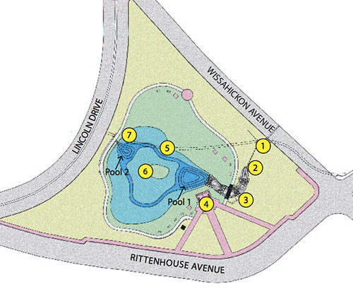
Saylor Grove Case Study
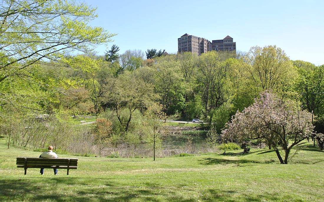
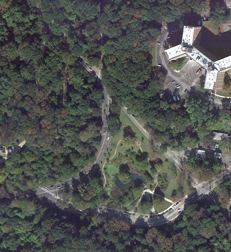
Left: Saylor offers visitor amenities in addition to stormwater management. Right: Aerial Photo of Saylor Grove Park. Image: GoogleEarth 40°01'47.90" N 75°11'12.31" W Image date 4/16/2013 accessed 1/30/2014.
In 2006 the City of Philadelphia completed a stormwater wetland to provide both stormwater management and improve water quality of stormwater leading to its source of drinking water. The watershed is 156 acres and the 0.7-acre wetland receives 73% of the watershed's annual runoff (25 million gallons). Called the Saylor Grove wetland, the project also includes educational panels, a trail around the wetland’s perimeter seating and renovation of sculptures and extensive re-vegetation. The stormwater management function is combined with beautiful space for visitors to enjoy within the 3.25-acre park. The wetland is sized to hold and treat the first 0.7" of runoff which includes 73% of the annual storms. Bacteria counts are reduced by the wetland and the wetland prevents 13 tons of suspended solids from entering the receiving creek. The biological diversity has been increased by the presence of water and re-vegetation using wetland and upland plants (Philadelphia Water Department).
Constructed Wetland Elements
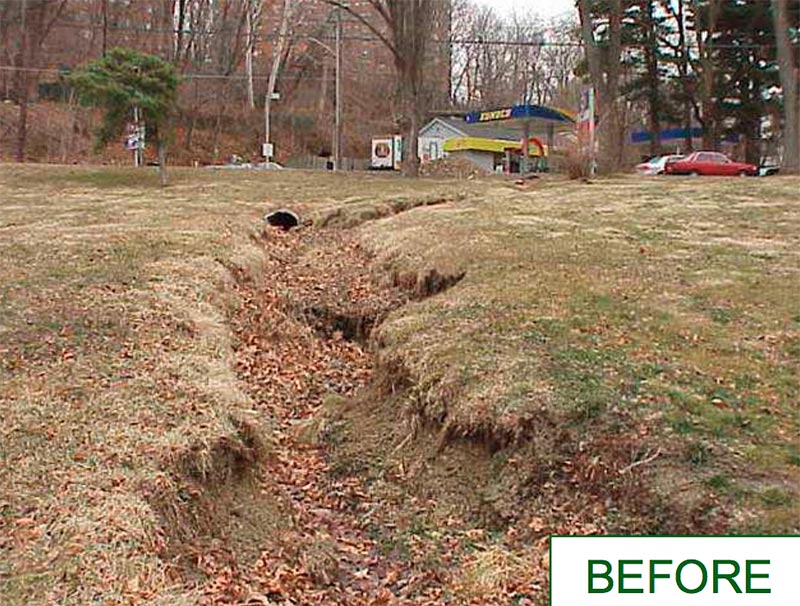
Saylor Grove Plan and the site condition before the wetland was built. Plan and Photo: phillyriverinfo.org
Enlarge the first image above to match the map symbols to the legend below.
- Stormwater diversion chamber
- Energy dissipator
- Stormwater inlet
- Overlook and educational panels
- Permanent pool (includes an entry and exit micro pool)
- Outlet structure (overflow for water above 2' above the permanent pool elevation)
The Saylor Grove project included the daylighting of a small perennial stream that had been buried in a pipe when the watershed was developed. This source of water in the dry season sustains the wetland vegetation. However, the 41.5 inches of annual average precipitation is well distributed throughout the year and the summers are humid. These conditions make sustaining constructed wetlands easer than in the arid Western U.S.
Chino Creek Wetlands
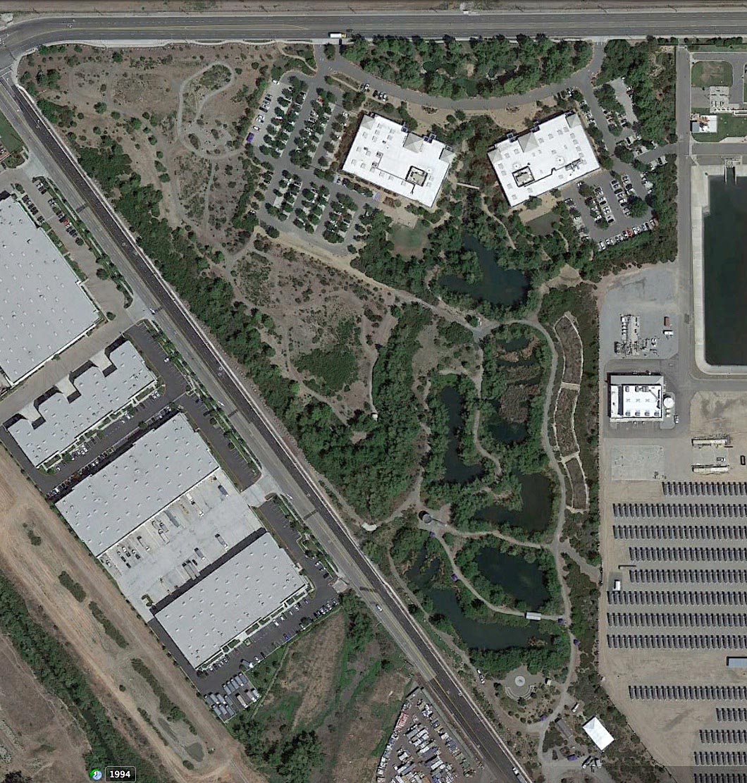
Image GoogleEarth 33°57'57.55" N 117°40'30.36" W Image date 4/16/2013 accessed 1/30/2014
This case study illustrates a stormwater wetland in a semi-arid environment. Located on Kimball Avenue in the city of Chino, California, about 35 miles southeast of Los Angeles, the park was designed to capture and infiltrate flows from a 25-year design storm and to attenuate flows from the 100-year storm event, 395 cubic feet per second (cfs), from a tributary area of 700 acres. This catchment is comprised primarily of commercial and industrial land uses.
The Chino Creek Wetlands Park is a 23-acre site and is adjacent to the 14-acre site of the headquarters for the Inland Empire Utilities Agency, including two office buildings and four parking lots. Conventional development of the headquarters site would have required transmission of the stormwater flow from the 700-acre watershed in a 10' x 10' box culvert to Chino Creek (at an estimated cost of 2 million dollars). The stormwater wetlands eliminated the need for the box culvert. This allows comparison of conventional and wetland costs and treatment effectiveness.
In 2001, a portion of Chino Creek included areas of extreme erosion where storm drains from new developments discharged into the creek. Water quality concerns had been identified in that section and the creek was on the Clean Water Act Section 303(d) list of impaired water bodies due to pathogen indicator levels. The site was formerly a dairy farm whose activities resulted in a contaminated site and flooding was a frequent on the adjacent El Prado road (S. California Water Committee, 2012).
Treatment Sequence
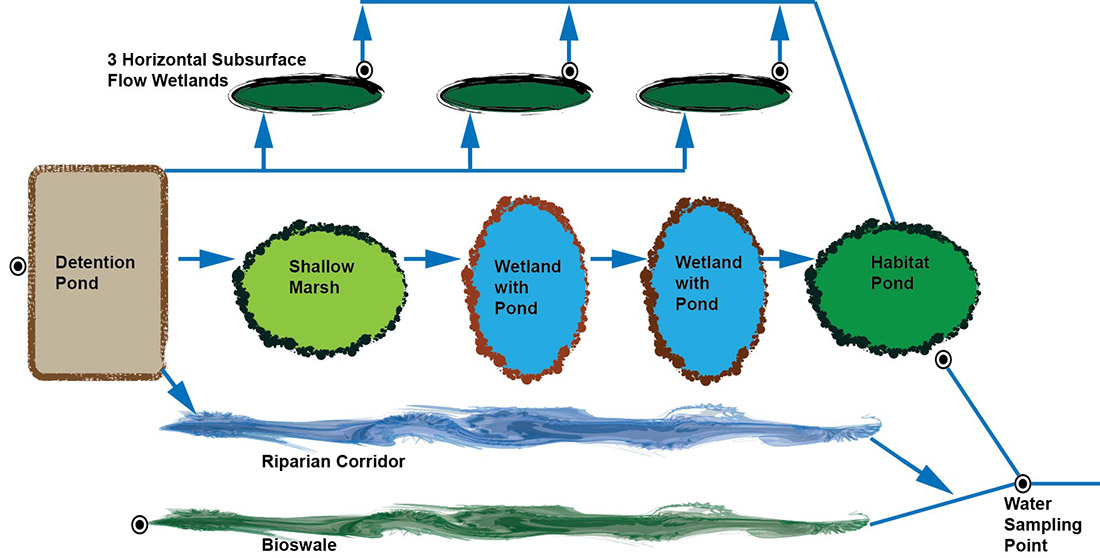
Left: Treatment sequence diagram, Austin. Right: Detention basin - the initial storage basin. Austin , 2014
Stormwater enters the park from two concrete vaults at points on the north and northwest edges of the site. Inflow from the tributary area is estimated to be 100 cfs from the northern vault and 295 cfs at the northwest vault when the catchment is fully developed. Currently, a 3' x 10' box culvert transports this flow under Kimball Avenue into an unlined stream (see image below) leading to a detention pond before entering the park for treatment.
In the first image above you can see the diagram of the flow and treatment sequences. The detention basin is located and has piping to divide the inflow into three types of wetlands: 1) Subsurface flow, 2) Surface flow emergent plant marsh and pond habitat, 3) Cottonwood and native willow riparian channel (S. California Water Committee, 2012). The second image shows the detention basin with its border of wetland vegetation.
In contrast with the temperate climate and the 41.5" of precipitation in Philadelphia, Chino receives 13.3" of precipitation on average with only one quarter of an inch falling in the hot summer. In order to sustain the stormwater wetlands in the summer, treated sewage effluent is diverted from the adjacent sewage treatment plant.
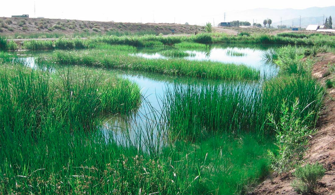
Left: Inflow stream. Photo: Austin, 2014. Center: Four wetland types. Image GoogleEarth 33°57'57.55" N 117°40'30.36" W, image date 4/16/2013 accessed 1/30/2014.
In the first image above, the channel leading from the off-site stormwater vault to the detention basin is shown with its riparian and upland planting. Enlarge the second photo. The three wetland types are depicted. On the right are the three curvilinear cells of the subsurface horizontal flow wetland. To the left of these are three pools. The uppermost one shows alternating bands of shallow marsh and deep water. The other pools have deep water centers surrounded by a bench with shallow water and wetland vegetation. Finally, on the left side of the image is the riparian corridor, which begins just below the detention pond emergency spillway.
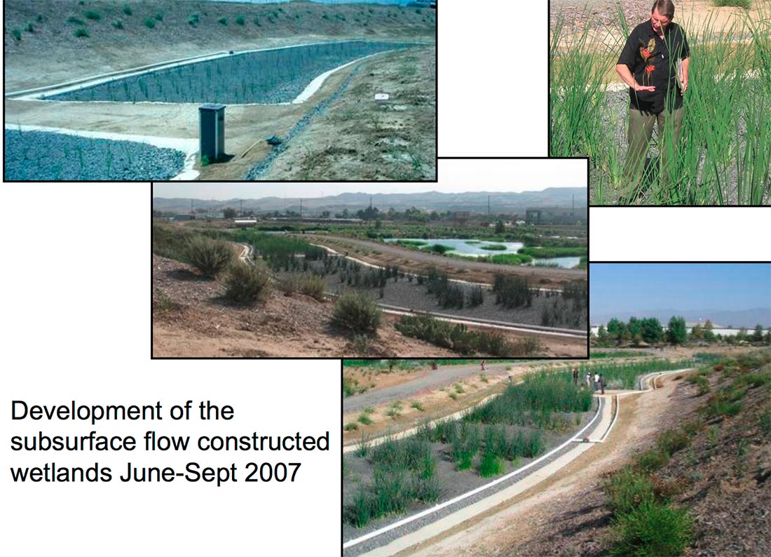
Left: Marsh grading. Photo: Inland Empire Utilities Agency, 2007. Center: Marsh wetland with emerging vegetaton. Photo: Inland Empire Utilities Agency, 2007. Right: Marsh. Photo: Austin, 2014
Enlarge the first image above to see the grading for the marsh. Notice the pattern of benches for vegetation and the trenches for mixing and redistribution of the water as it moves through the wetland. The center and left images show the same wetland area at different years of maturation in the spring and winter seasons.
Left: Horizontal subsurface flow wetland. Photo: Inland Empire Utilities Agency, 2007.
Horizontal subsurface flow wetlands are primarily built for anaerobic removal of organic matter and conversion of nitrate to nitrogen gas. They are not a stormwater storage system primarily. We will study this wetland type in a later tutorial.
The Chino Creek Wetland park cost about $3 million resulting in a $33,187 cost per acre-foot of water stored. An economic study of the Chino Creek Wetlands found that this approach of collecting stormwater from the watershed, retaining and treating it at a neighborhood or regional facility is about half the cost of accomplishing these same functions on small sites within the watershed.
Study Questions
Rooted macrophytes (wetland plants) generally require water depth less than ______ feet?
Draw a plan view of the Saylor Grove stormwater wetland.
List five structural elements included in the design of the Saylor Grove wetland.
Conventional development of the Inland Empire Utilities Agency headquarters would have required which stormwater device at what cost?
The Chino Creek Wetlands are designed to retain the ______ -year design storm.
List the three types of stormwater wetlands included in the Chino Creek wetlands park.
What is the supplemental source of summer water for the Chino Creek wetlands?
At the Chino Creek wetlands what technique is used in the marsh to mix and redistribute water to the vegetated benches?
Is a stormwater treatment park a cost effective way of managing and treating stormwater compared to capture and treatment on individual parcels within the watershed?
References
http://www.phillywatersheds.org/
http://www.phillyriverinfo.org/WICLibrary/Tour%20Guide2%20Compressed.pdf
Southern California Water Committee . 2012. "Stormwater Capture: Opportunities to Increase Water
Supplies in Southern California." http://www.ocwd.com/Portals/0/Pdf/SCWCStormwaterCaptureREPORT2612.pdf