Principal Investigator: John Oldow (UI)
Regional gravity data have been collected along numerous transects within the Alvord
Basin (see map below).
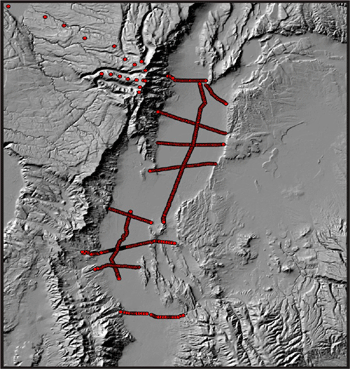 Map of the Alvord Basin showing the location of gravity line surveys.
 |
Discussion coming soon...
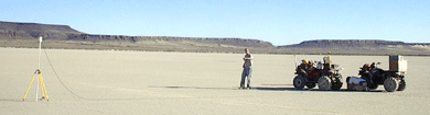 UI students collect gravity data in the Alvord Basin.
 -- photo by T. Jones |
|
Discussion coming soon...
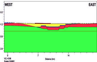 Geological cross section along Powerline Road, south of Borax Lake, interpreted from micro-gravity measurements.
The z-axis is depth (km) below sea level. Colors indicate the following: yellow (basin fill), blue (tuff), pink (basalt), green (andesite basement).
Geological cross section along Powerline Road, south of Borax Lake, interpreted from micro-gravity measurements.
The z-axis is depth (km) below sea level. Colors indicate the following: yellow (basin fill), blue (tuff), pink (basalt), green (andesite basement). |
|