Life at Interfaces: Biocomplexity in Extreme Environments

hot spring banner
WELCOME to the NEW VERSION of the Idaho EPSCoR "Biocomplexity in Extreme Environments" webpage!

2-D SEISMIC:

3-D SEISMIC:

Principal Investigator: John Bradford (BSU)

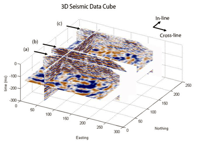
A seismic reflection profile across the entire basin (11 km) just south of Borax Lake, along Powerline Road, provides a large-scale interpretation of structural geometry used to aid additional studies conducted at a higher resolution in the immediate vicinity of thermal springs north of Borax Lake.

photo of Powerline Road
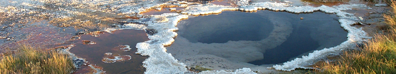
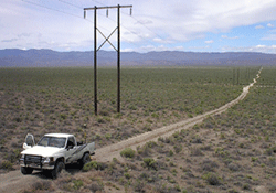
Looking northeast across the basin along Powerline Road.
--Photo by T. Jones

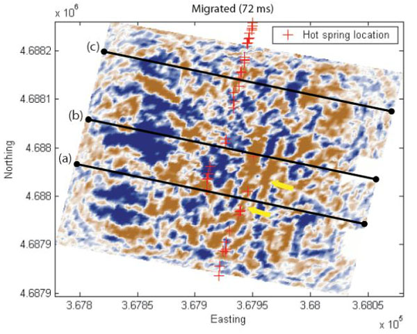
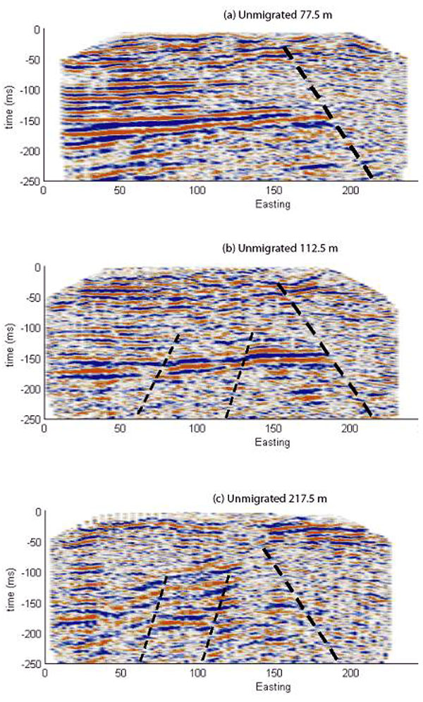
Results of the 2-D basin-scale study reveal the presence of shallow bedrock near the center of the basin and verify that a fault zone is present beneath the Borax Lake hot springs area.

map of Borax Lake area
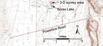
Location map for the Borax Lake area showing the 2-D seismic transect along Powerline Road and the 3-D survey area.
seismic profile along Powerline Road
[Click image to enlarge]

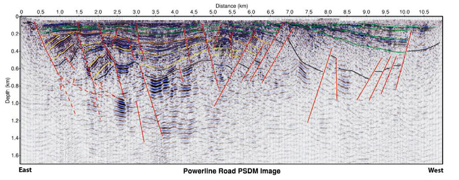
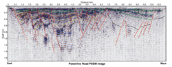
Seismic reflection profile showing a complex normal fault zone believed to control hot springs formation north of Borax Lake.

Principal Investigator: John Bradford (BSU)

3-D seismic surveys within the step-over region of the Borax Lake fault are used for imaging fault structure and potential flow pathways for geothermal fluids. Refer below for details.

3-D seismic data from Borax Lake

seismic data time slice
A time slice at 72 ms (~60 m depth) from the migrated seismic data cube shows linear features (marked with the yellow arrows) that are oriented similarly to the surface trend of the hot springs (denoted by the red crosses). The black line denote the locations of the in-line slices. [Click to enlarge]
In-line slices from the unmigrated data show a large normal fault dipping to the east that terminates a major reflector that appears around 150 ms. The small offsets are probably due to smaller faults associated with the rotation of strain. The basement reflection terminates on the east side of the survey area because of a normal fault striking approximately NNW and dipping 60° ESE. The fault tracks through overlying sediment structures and lines up with the surface expression of the hot springs; furthermore, this major fault is likely one of the main sub-surface structures that controls preferential fluid flow paths.
seismic data in-line slices
The cross-sections are in order from north to south.
[Click to enlarge]
last update: June 2006 | webmaster: jhinds@uidaho.edu