| |
|
|
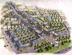
Welcome |
| |
Physical Urban Design
Study Questions for Physical Urban Design are highlighted in red in the left column below.
Elements of Urbanism
|
Kevin Lynch made a case for what he called normative planning to be considered equally with decision theory and functional planning theroy. He illustrated that city form could be understood as a sequence or pattern of districts, edges, nodes and paths. This typology encouraged physical designers to master plan neighborhoods and towns in ways that provided these structural features. Others added the threashold or portal as another elemental building block of positive urban form.
We have made progress since Lynch wrote in the 1970's but most contemporary planning continues to disappoint designers and citizens. More recently, Adnres Duany, Elizabeth Plater-Zybek, Peter Calthorpe, Randolph Hester and other have advanced the practice of community master planning. The material below draws heavily from these sources.
The basic elements of urban development are the neighborhood, district and corridor. |
| |
|
Neighborhood
|
- Features a center and an edge
- Mix of activities
- Optimal size - 1/4 mile radius
- Composed of blocks within a network of streets
- Priority locations are dedicated to public space
According to Randy Hester, the ideal population of a neighborhood ranges from 5,000 to 7,000 people. The neighborhood should be separated from adjacent neighborhoods by open space buffers 100 to 1,500 feet wide. The neighborhood can support about 150,000 square feet of commercial space. |
| |
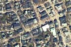
|
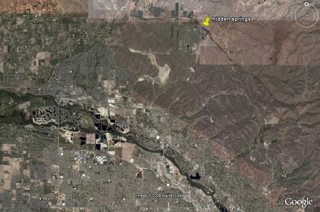
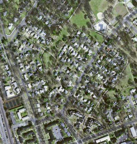
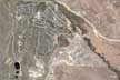
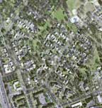
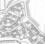
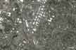
(GoogleEarth 2008) |
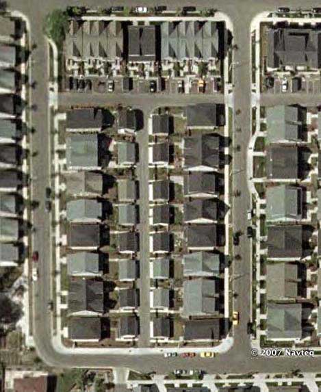
Hidden Springs is an example of a planned community established as a planned unit development 10 miles northwest of Bosie. The remote location is clearly a detriment to the sustainabilty goals of the community. The developer initiated a program to reduce the vehicle trips per day. This has achieved 8 trips per day compared to 10.5 which is typical for single use low density residential neighborhoods. |
| |
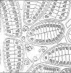
|
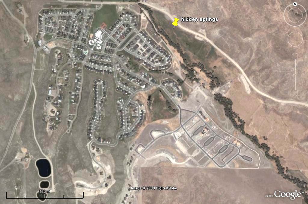
(GoogleEarth 2008)
|
Of the 1,700 acres, 1,000 arcres (60%) are preserved as open space. The lower left corner of this image show the three waste water treatment ponds. The development includes a charter and private school and care center for young children. |
| |
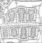
|

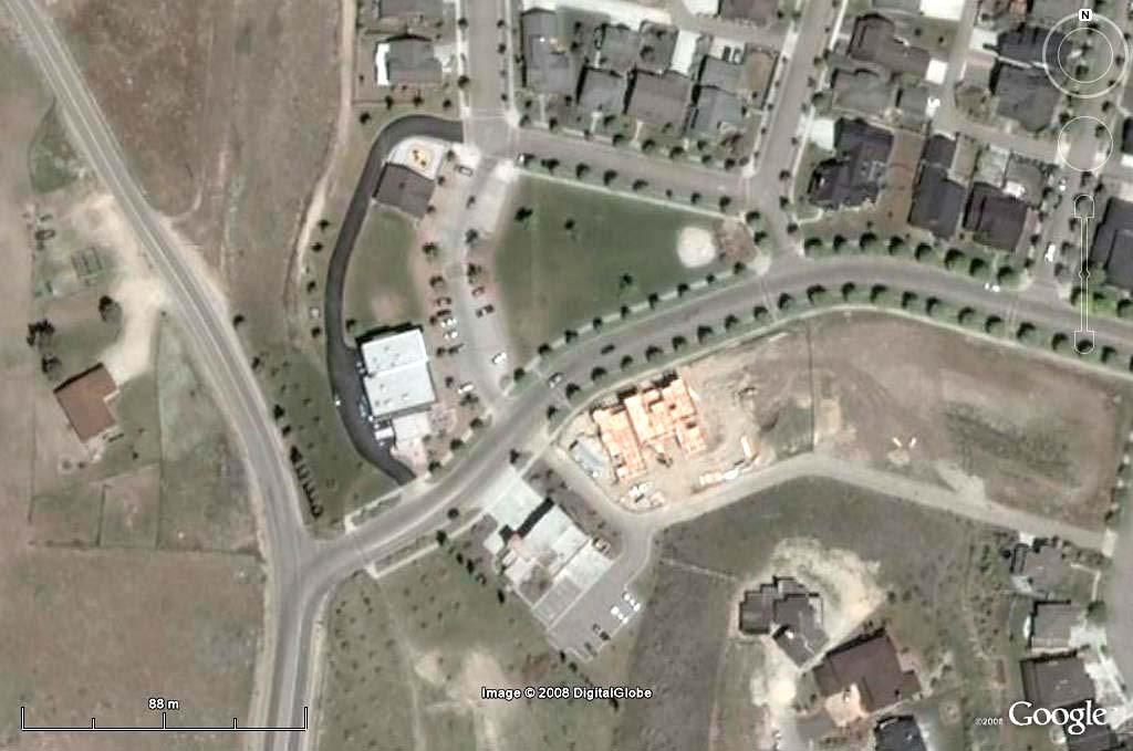
(GoogleEarth 2008)
|
The town center including a park, store, restaurant, fire station and library was built in phase one of the development. The project includes a community supported farm. |
| |
|
District
|
Functionally specialized, such as a campus, air ports, etc. Except where uses are truly incompatible, single use districts should avoided in favor of mixed use. |
| |
|
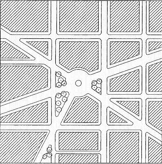
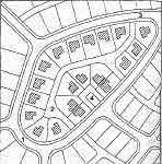
| Corridor

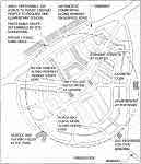
Leeland Station Plan
(DPZ, 2007)
|
Connector of neighborhoods and districts
May form the edge of neighborhoods and districts
Includes wildlife corridors and public transit alignments
The plan at left is over-laid on an aerial photo of the larger landscape. Enlarge the image and study the relationship between the regional drainage system and the corridors. They form the edges of the neighborhoods while providing wildlife habitat and recreation opportunities.
These corridors are the green infrastructure assisting the stormwater treatment necessary after the site is made more impermeable by roads and roofs. Using an landscape ecology approach as a means to generate urban form is discussed in detail by Charles Waldheim. The structural elements of the natural landscape are the matrix, patch, corridor and network. For more information see the ecology link on this web site. |
| |
|
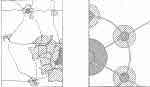
Urban Neighborhood
(Hooper, 2007)
|
The two schematic designs presented at left summarize neighborhood and village design principles refined by DPZ. Enlarge and study this plan.
|
Rural Village
(Hooper, 2007) |
The design of the rural village is similar to the pattern of the neighborhood. Study the similarities and differences in this drawing and the one above. |
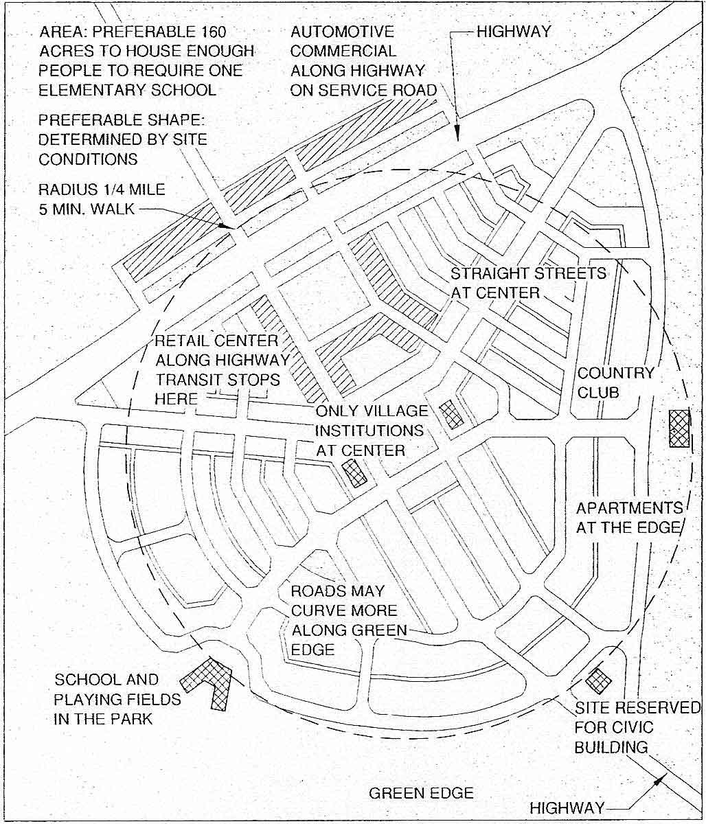
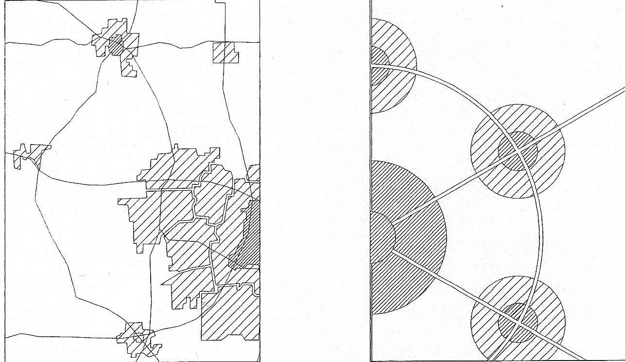
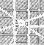
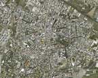
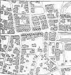
Regional City Types
|
Historically the spatial configuration of cities and towns in the United States was strongly influenced by transportation technology and topography.
|
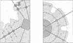
 Left - Madison 1993; Right - Towns and Villages -Schematic Left - Madison 1993; Right - Towns and Villages -Schematic
(Hooper, 2007) |
Town and Village Model
An important urban center surrounded but separated from smaller, largely self sufficient towns. This is a pattern typical in the United States before the impact of the railroad. An example is Madison Wisconsin. |
 Left - Baltimore 1950; Right - Linear City -Schematic Left - Baltimore 1950; Right - Linear City -Schematic
(Hooper, 2007)
Be able to diagram the pattern of the linear city model.
|
Linear City Model
Heavy rail and street cars attract urban development as they extend from the city. The resulting form is alternating wedges of open space and urban development. An example is Baltimore in 1950.
|
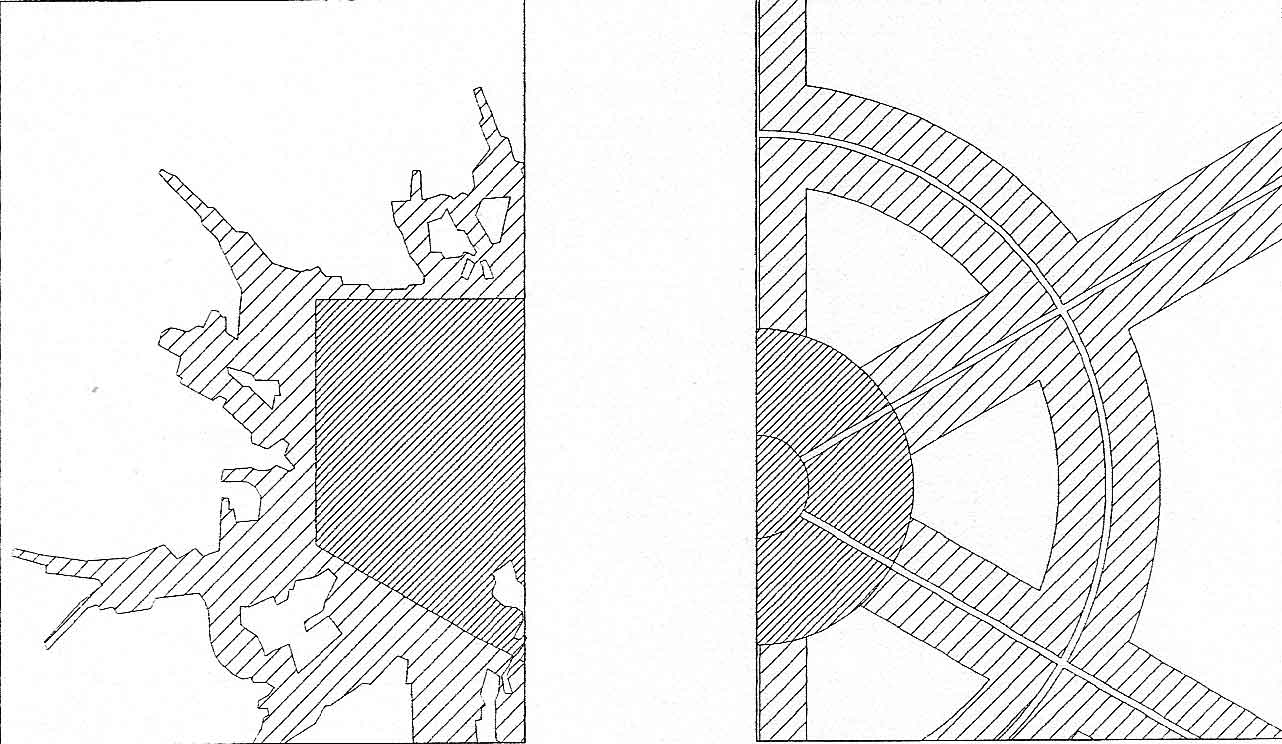
 Left - Portland, 2020; Right - Transit oriented design-Schematic (Hooper, 2007) Left - Portland, 2020; Right - Transit oriented design-Schematic (Hooper, 2007)
Be able to diagram the pattern of the TOD city model. See also the unit on TOD's |
Transit Oriented Design Model
Heavy rail or light rail lines radiate from the regional city and encourage nodal development around stations. A secondary bus system connects minor nodes perpendicular to the rail line. Example - Portland proposed configuration in 2020. The automobile compromises and eventually destroys each of the patterns established in the models above since it can move anywhere, resulting in undifferentiated sprawl. Therefore, planning controls such as growth limit lines and conservation easements are necessary to encourage efficient development and retain farm land and wildlife habitat. |
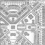
| Types of Neighborhood Plans
|
 Orthogonal Grid - Savannah, GA Orthogonal Grid - Savannah, GA
(Hooper, 2007)
 Grid with Diagonals - Washington D. C. (Hooper, 2007) Grid with Diagonals - Washington D. C. (Hooper, 2007)
|
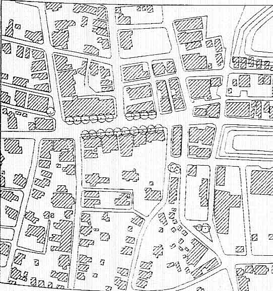
A study of neighborhood plans reveals a typology. Each has advantages and disadvantages. Some like the orthogonal grid (Savanna, Georgia) make for easy directional orientation. Others, such as the organic network (Nantucket, New York) are responsive to hilly terrain.
Study the examples provided at left. Which ones accommodate environmental disruptions well and which ones would handel these poorly?
Which ones might be monotonous and which ones are intrinsically interesting?
Which ones express a natural hierarchy of streets?
Which one have a variety of blocks and lots?
Which ones concentrate traffic and which ones disperse it? |
| |
|
 Diagonal Network -Mariemont, NY (Hooper, 2007) Diagonal Network -Mariemont, NY (Hooper, 2007)
|
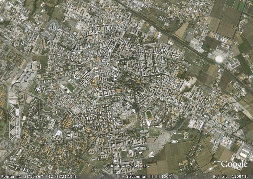
Latina, Italy is a town designed in 1928 that used the diagonal network town plan (Austin, 2007). However, the plan of this town references Palmanova, another ideal town, designed and built in the Renaissance in Italy. |
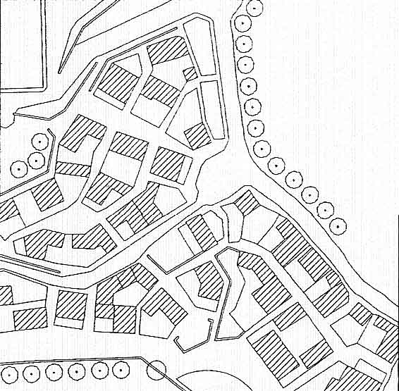
Organic Network - Nantucket, MA
(Hooper, 2007)
|
The irregularity of the plan suggests incremental growth and response to local conditions. The eccentric character can result in a strong sense of place and great variety but also some inefficiency.
Nantucket, (Goggle Earth 2007)
|
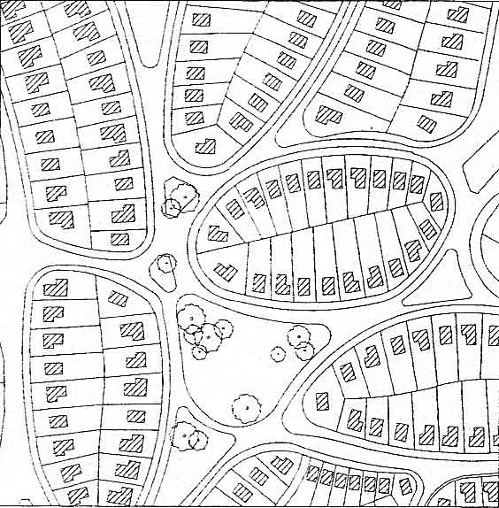
 Curvilinear Network - Riverside, IL Curvilinear Network - Riverside, IL
(Hooper, 2007) |
|
Discontinuous Network - Radburn, NJ
(Hooper, 2007) |
Radburn (Goggle Earth 2007) |
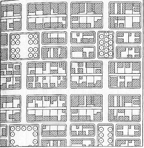
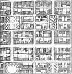
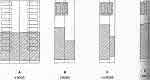
| Block Types |
|
 Square Block with Subsequent Subdivision Square Block with Subsequent Subdivision
(Hooper, 2007) |
Since the block is one of the basic elements of the neighborhood its useful to understand various ways of forming the block. The form of the block impacts pedestrian circulation, distribution of uses, response to the terrain and even socioeconomic life.
The square block provides for a range of lot sizes or an internal parking or common area.
|
Square Block - perimeter platting
(Hooper, 2007)
|
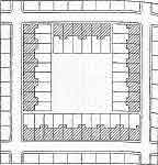
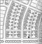
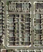
Square Block at Norton Commons- perimeter platting creates a street wall perforated with inlets to the parking area in the center. (DPZ, 2007)
The second image at left is a built example of a viriety of housing types for higher densit y living. Enlarge the image and study each type. Notice the use of the Square Block pattern where parking is at the center of the block. |
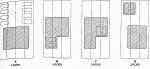
Organic Block |
The organic block provides for greater variety and excellent response to terrain and environmental interruptions. It requires skilled platting since it is not standardized. Note the way lots are handel ed at acute angles and where block width is excessive. |
Organic Block - residual land between well-worn paths
(Hooper, 2007)
|
Organic Block - planned naturalist
(Hooper, 2007) |
| |
|
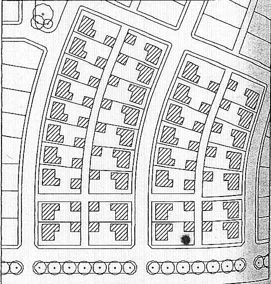
Elongated Block |
The elongated block features doubled loaded alleys. Varying the width of the block can make a transition at the rural edge of a town or reduce cross streets. Notice in the plans and aerial photo below that the parking is in the rear and accessed by an alley. This prevents the front of the small lots from being dominated by garages and parked cars. Also note that the alleys connect all four perimeter streets. |
 Elongated Block - 2 frontage types: single family detached residential and town house. (Hooper, 2007) Elongated Block - 2 frontage types: single family detached residential and town house. (Hooper, 2007) |
Elongated Block - deflected alignment to reduce monotony of blocks or to respond to landform.
(Hooper, 2007)
|
New Holly Elongated Block
(DPZ, 2007)
|
|
| |
|
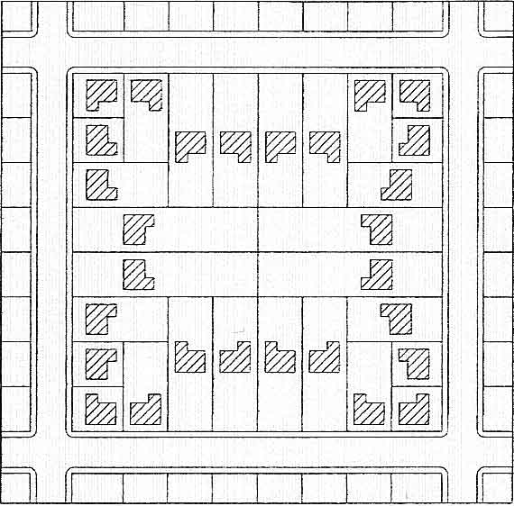
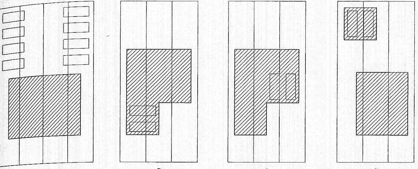
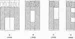 Courtyard Building Courtyard Building
(Hooper, 2007)
|
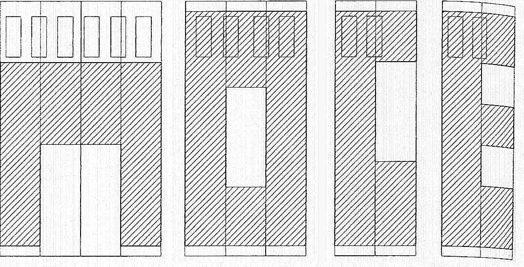
Traditional platting in the United States was based on the 50' module. This allowed 25' townhouses and store fronts. Multiples of the unit were made residential lots. However, the traditional subdivision unit results in inefficient land use since the double row parking lot requires 64' of with. Dividing 64' by four results in a planning subdivision unit of 16' which in the minimum width of a row house and allows for one car and room for a pedestrian to pass.
Using the 16' module for a complete building envelope or multiples of it, four building types are common and result in efficient parking function. The courtyard building is the most urban of the types. The open space is partly or completely enclosed by the building rectangles (rods).
|
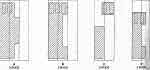 Side Yard Building Side Yard Building
(Hooper, 2007)
|
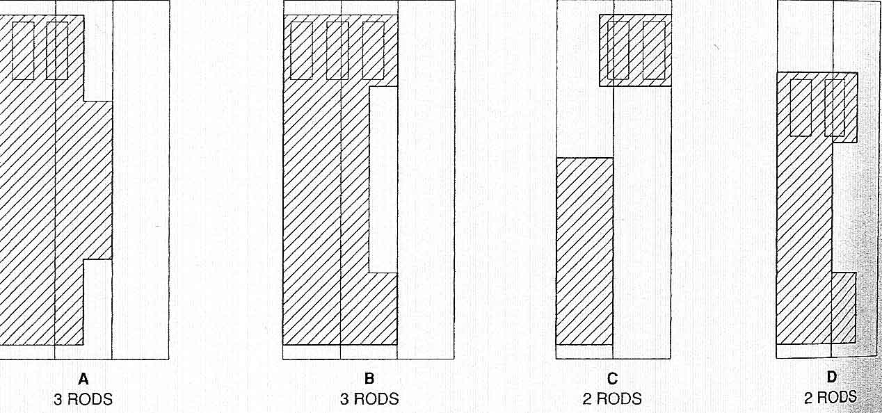
The side yard building type requires a 32' lot width. It responds to the need to orient buildings for passive solar heating or natural day lighting.
|
 Rear Yard Building Rear Yard Building
(Hooper, 2007)
|
The rear yard building type places the structure on the front the lot making the rear of the lot available for parking or accessory buildings. The type is useful for town houses with a garden or outbuilding as well as for modest retail or office uses.
|
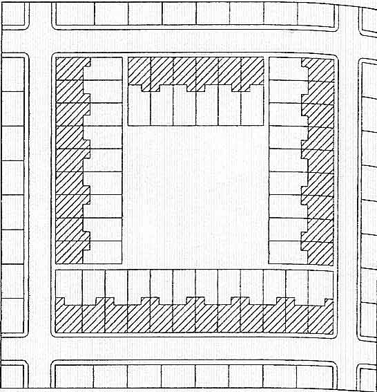
 Perimeter Yard Building Perimeter Yard Building
(Hooper, 2007) |
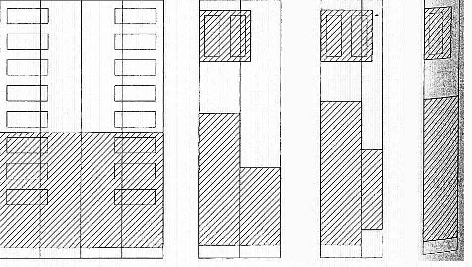
The fourth building type is the perimeter yard building. This is the most suburban with building setbacks on every side. It provides for a semi-public front yard. The impact of the buildings and landscape is compromised by automobiles a front driveway or garages that extend in front of the building facade. The diagrams show positive garage and parking configurations.
Civic, transportation buildings and some manufacturing uses require exemptions from the 16' module. |
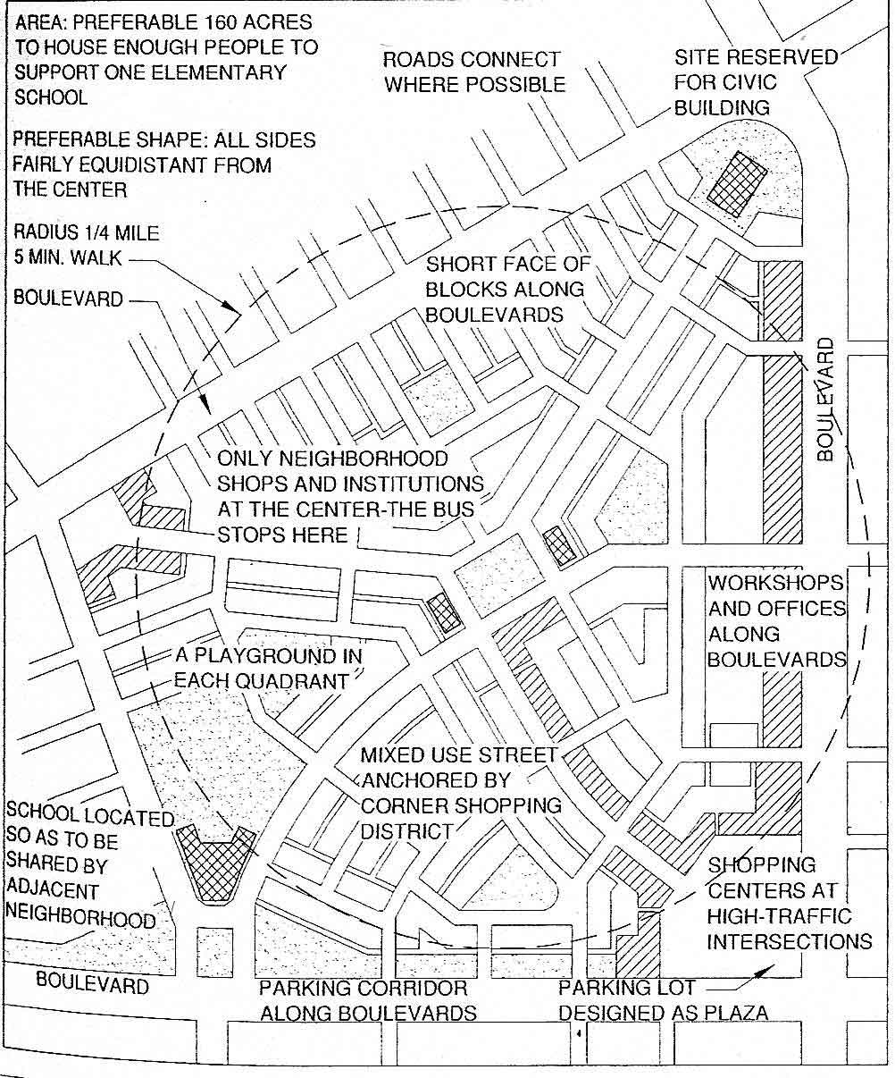
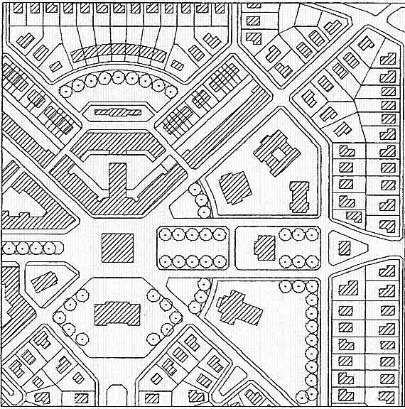
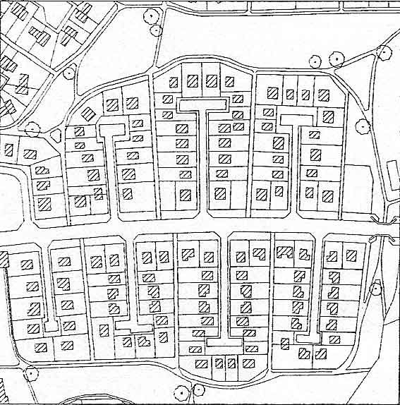
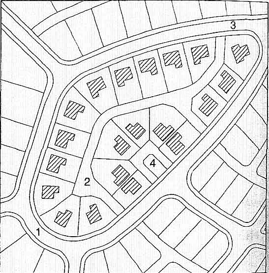
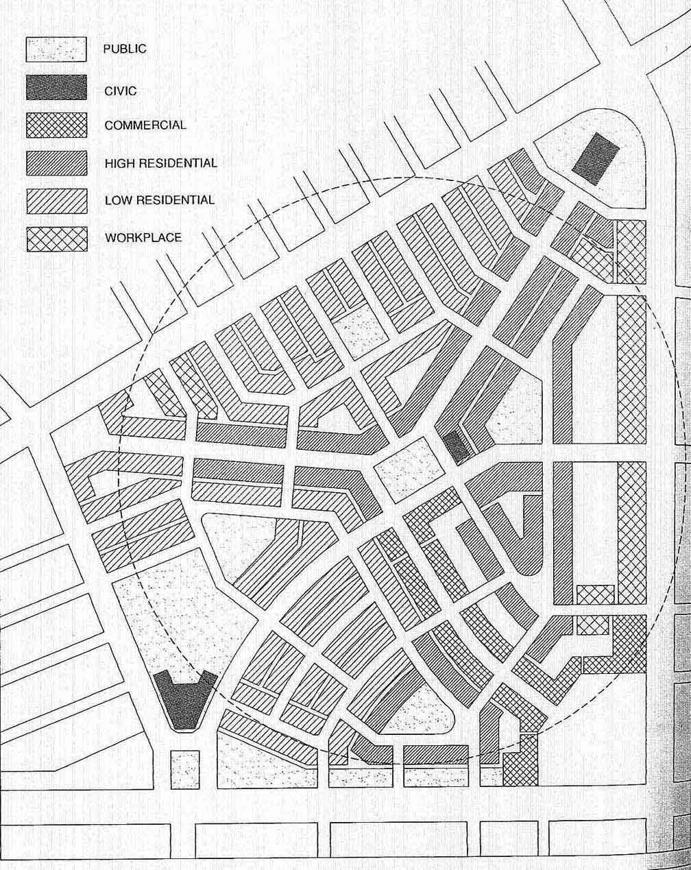
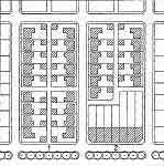
Traditional Neighborhood Design
|
This plan is a model of traditional neighborhood land use . |
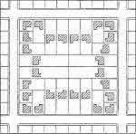
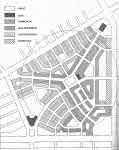 Model Traditional Neighborhood (Hooper, 2007) Model Traditional Neighborhood (Hooper, 2007)
Enlarge the plan and study its elements. Be able to diagrams the plan and discuss the size of the neighborhood and the land uses including civic, high density residential, low density residential, commercial, public and work place uses.
|
|
|
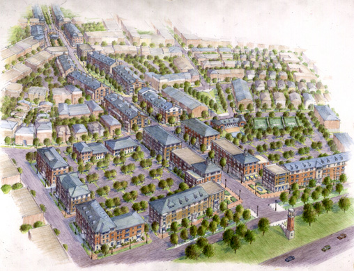
Past Projects of This Studio |
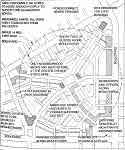
We have contributed to the positive planning and design efforts of many communities during the ten years that this combined studio has been doing outreach work. We have worked in these Idaho communities: Orofino, Riggins, Grangeville, Harrison, Hayden, Sandpoint, Lewiston, Star, Rupert, New Meadows, McCall; these Washington communities - Clarkston ; and these Montana communities - Seeley Lake.
|
|
|
|
|