Introduction
A set of study questions is available here to help you focus your attention on some important points. |
This web page provides examples of the community planning and design projects that the University of Idaho has completed. Use the samples to gain an understanding of the process and products produced for community clients. Your project this semester may not require all of the products shown here but they are typical of most professional practice products that you will encounter if you do community planning and design professionally after you graduate. All projects were studio based and coordinated by Gary Austin, Anne Marshall and Wendy McClure.
Community planning and design relies heavily on participatory processes. The designer becomes the facilitator that draws out the community vision and gives it expression, the "community's pencil" as Wendy McClure likes to say.
|
Citizen Participation |
The facilitation of citizen meetings is an important community design and planning activity that often involves architects, landscape architects or planners. There are two types of facilitation roles that the designer commonly manages. The first is visioning or goal setting. |
Visioning
|
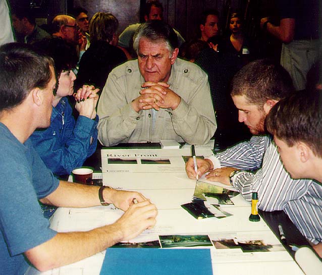
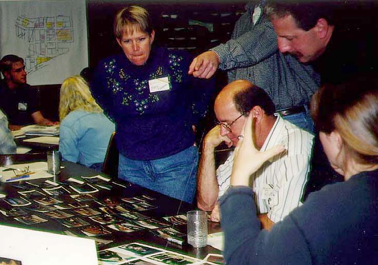
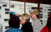
Visioning or goals setting requires that the citizens review the existing conditions or features of their city or town. Then the citizens can begin to assess these features in terms of location, function and other parameters.
In this image, citizens are considering photos of the physical features of the town in photographs taken earlier by students. This helps to both appreciate and value the positive attributes of the town and identify problems to address. It also helps put all of the citizens on an equal footing since they are all seeing the same inventory of elements of the town. Sometimes residents are surprisingly ignorant of elements outside their own neighborhood.
Another slightly different exercise also helps formulate community goals and visions of the future. When citizens are provided with a large set of images of elements in other towns they can begin to adopt or reject certain aesthetic directions, density goals, parking schemes, open space elements, architectural materials, etc.
|
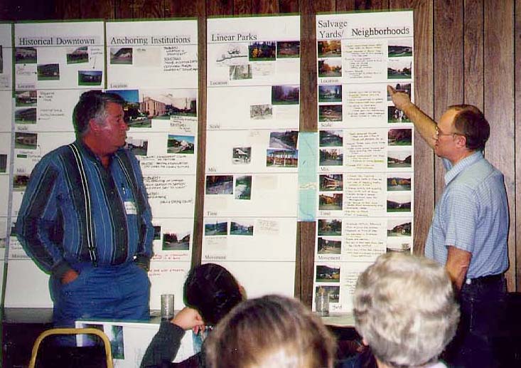
Matrix Tool |
One device to help citizens understand the physical features and their relationship to more abstract planning concepts is shown below. This workshop activity was devised by William Morrish in Planning to Stay and was used a few years ago to help the town of Orofino, Idaho to set goals.
Each of the physical features of the community (listed on the horizontal axis) is assessed according to five organizing themes (listed on the vertical axis) by a number of citizen teams.
| |
Homes and Gardens |
Community Streets |
Neighborhood Niches |
Anchoring Institutions |
Public Gardens |
| Location |
|
|
|
|
|
| Scale |
|
|
|
|
|
| Mix |
|
|
|
|
|
| Time |
|
|
|
|
|
| Movement |
|
|
|
|
|
|
Completed matrix
|
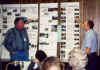
After the citizens assembled their images on the matrix they made notes about the positive and negative aspects of the elements. The citizen teams presented their findings to the audience. In the citizen participation exercise conducted by the University of Idaho for the city of Orofino there were two goals for the workshop. One goal was to obtain a set of problems and opportunities for the design teams to address. The second goal was to have the ideas generated by the citizens ranked by all of the citizen participants. |
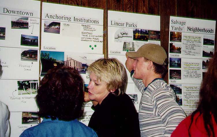
Prioritizing
 |
At the end of the evening, the citizens each placed 6 votes (represented in this image by green dots) on the matrix. This voting established a prioritized list of elements desired by the citizens participating in the workshop.
Setting priorities in this democratic way permits the minority views to be expressed but allows the design process to proceed.
|
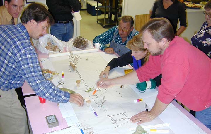
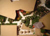
Design Workshops
|
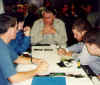
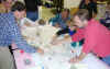
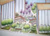
The second type of facilitation for community planning is the design workshop. In this community activity the citizens manipulate plans or a "box of parts" to establish basic design concepts that can be refined by the designers.
In the first image shown here the citizens of Star, Idaho are developing a main street improvement plan by adding model parts and drawing on a plan provided by the student facilitators.
The role of the facilitator is to make sure that everyone has an opportunity to express their views and to answer technical questions.
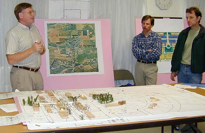
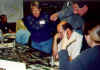
In the second and third images show a citizen devised model of proposed mixed use development and the creation of a new urban center for the town. The student facilitators provided the base map and the raw materials for the exercise. The citizen teams presented their solution to the student and community audience.
Its important that the design professional allow the citizen to present the concepts. This helps them get to know each other and helps leaders emerge who will carry the project forward after the planning team leaves. |

The Box of Parts product shown above expresses the density that the community is willing to accept

|
|
|
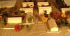
Site Inventory
Massing model to illustrate existing conditions
|
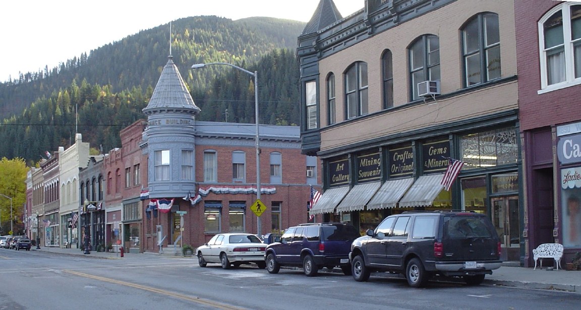
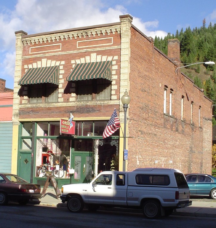
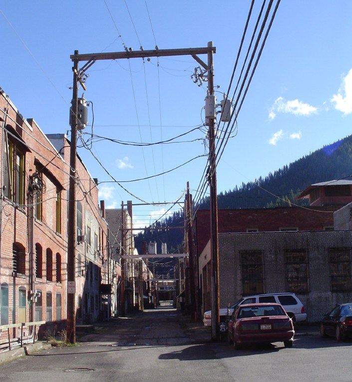
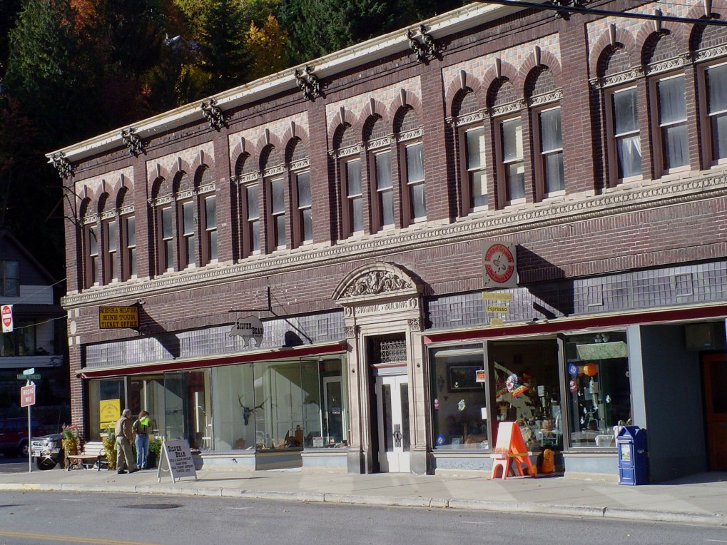
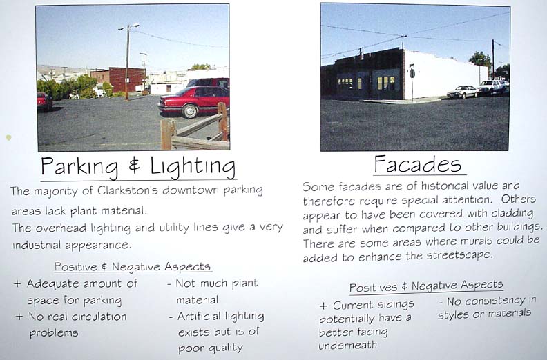
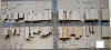
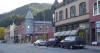
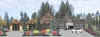
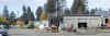
An inventory and analysis of existing site conditions is one of the first steps in a design process. Information is collected during on-site visits and from maps, reports, historic documents and other sources. Project information might be collected on the central business district, buildings, streets, intersections, sidewalks, plantings, parking lots, proposed parks and paths. The images below and at left show documentation of existing conditions as modes, drawings and photos.
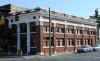
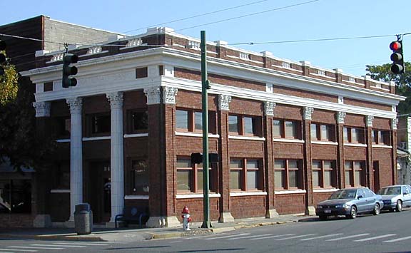
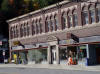
High quality historic architecture
|
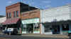
Historic building facade (on right) covered with new materials - candidate for restoration |
 |
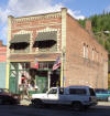
This former brothel is part of the historic heratage of the town |
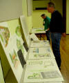
Public presentation of the inventory and analysis phase assures the public that the process has been deliberate and through |

The range of housing stock is important. This house is also historically significant since it was part of a company town. |
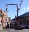
The location of utilities must be mapped since it can have a great impact on cost. |
Historic building |
|
|
Site Analysis
|
After information is collected is must be judged as to whether it represents an opportunity or constraint to good function and aesthetics. In this example, Circulation and Access Roads is assessed for the community of Star, Idaho.
The example below illustrates analysis text.
POSITIVE: Historic district has ample road access and connectivity throughout.
NEGATIVE: Newly developed areas have poor connectivity and access to the existing road system; also the blocks in new subdivisions are too large. This growth pattern could continue in the absence of planning.
DESIGN IMPLICATIONS: Future developments must have a fine net work of roads that provide connectivity and access to existing developments. |
|
Schematic Design
|
|
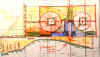 |
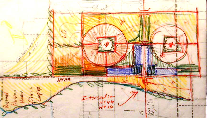
Schematic design is a functional, bubble or planning diagram. In the example shown here for Star, Idaho, a Transit Oriented Design concepts illustrate high density residential development with pedestrian access to light rail stations. |
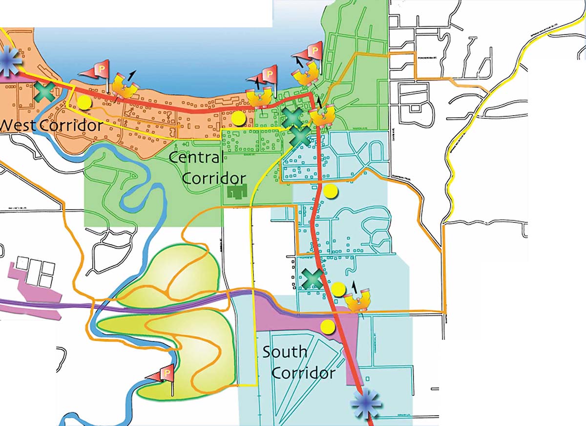
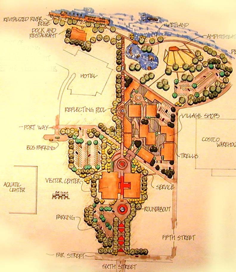
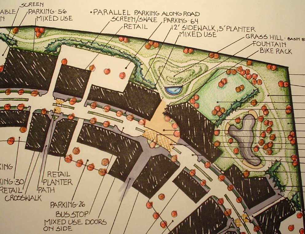
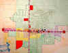
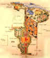
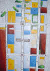
Preliminary Master Plan
|
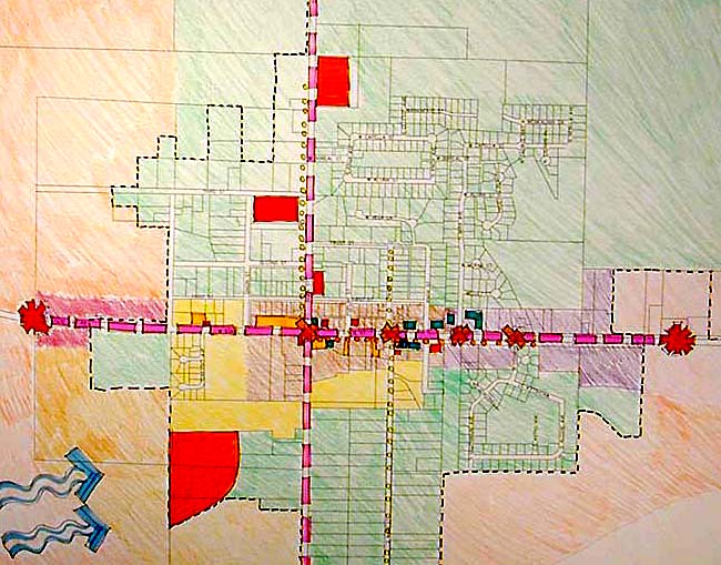
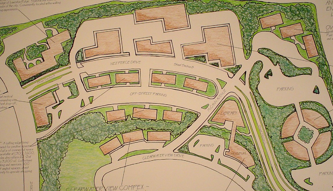
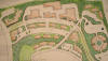
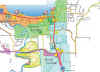
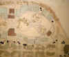
Preliminary master plans differ according to the project type. In the first image at left for McCall, Idaho, is a master plan that identifies points within the city where design interventions are recommended by the student planners. In the second image, the illustrative design shows a more detailed portion of Clarkston, Idaho. Several focus areas are included in the extent of the master plan. In fact, this graphic was created after considerable work had been done on the focus designs. The advantage to this preliminary master plan is that it clearly summarizes the focus designs for the public presentation of the project.
The third image is of a master plan for a downtown where the buildings and spaces are color coded to indicate the kind of design intervention proposed.
 |
|
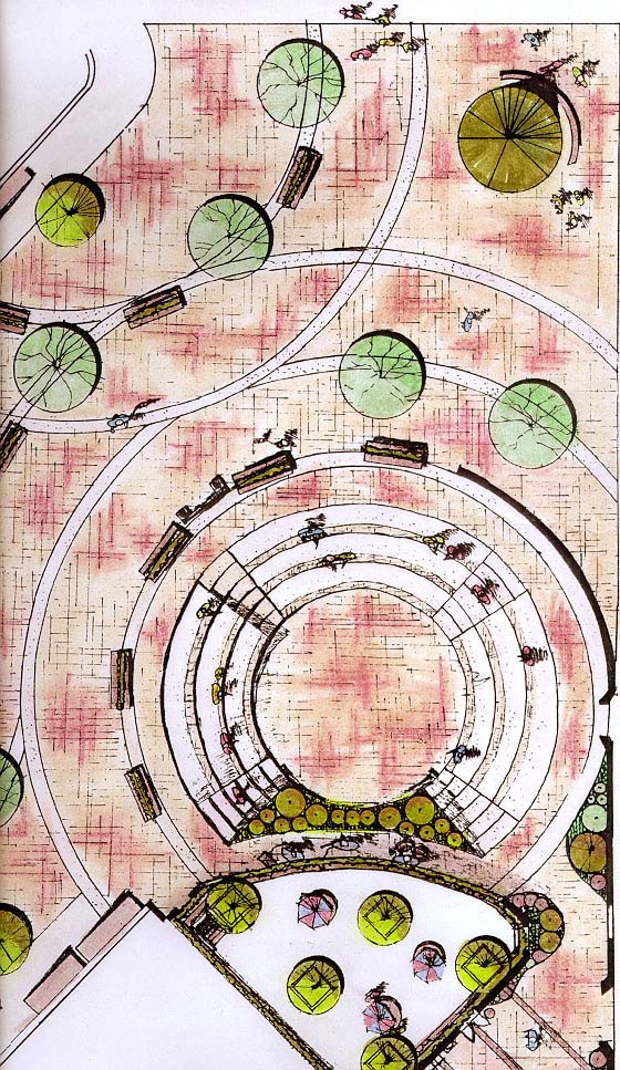
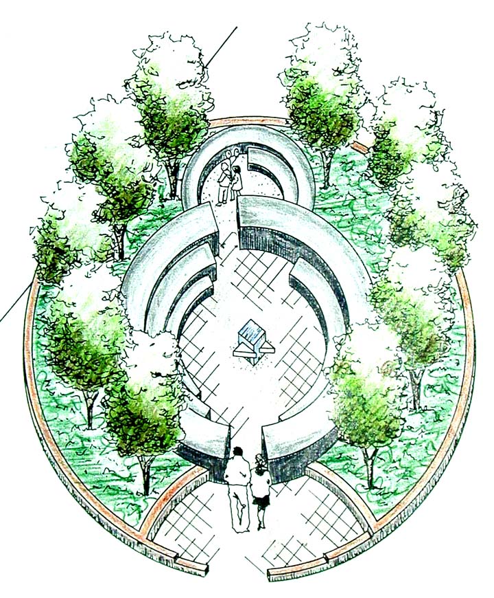
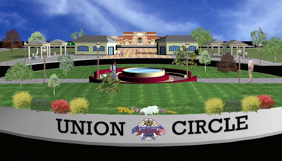
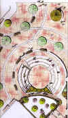
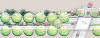
Design Development of Focus Areas
|
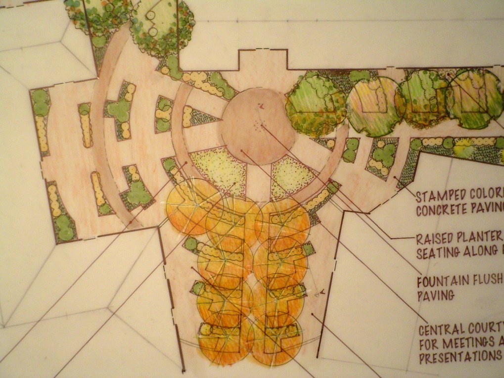
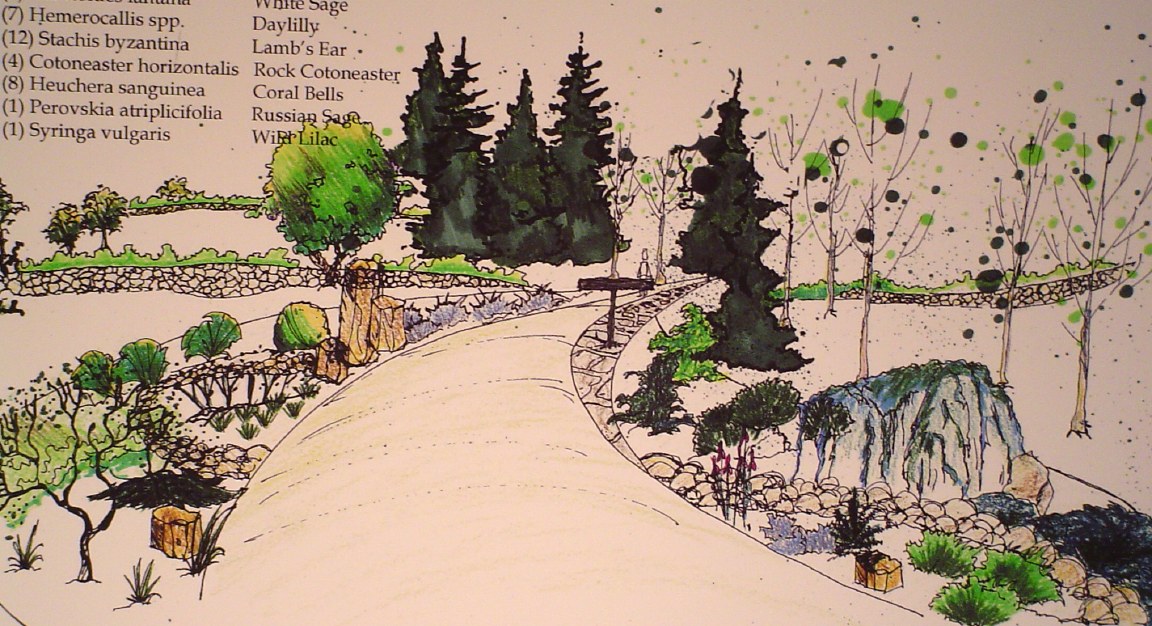
Focus area designs are detailed design proposals represented by plans, sections and models. In the first example here, a team of architects and landscape architects created an urban plaza adjacent to a proposed building to support public events (it included public restrooms) in Rupert, Idaho. The proposed project created new civic facilities out of a derelict street and adjacent to a historic theater scheduled for restoration. The second image is a design proposal for a city arterial in Rupert, Idaho. In includes realignment, a native and drought tolerant plant list, and gateway to the city center.
|
 |
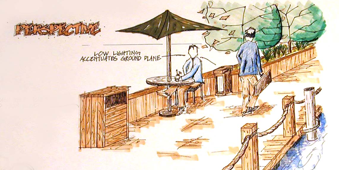
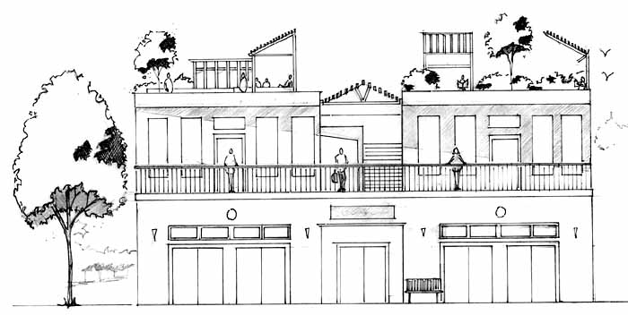
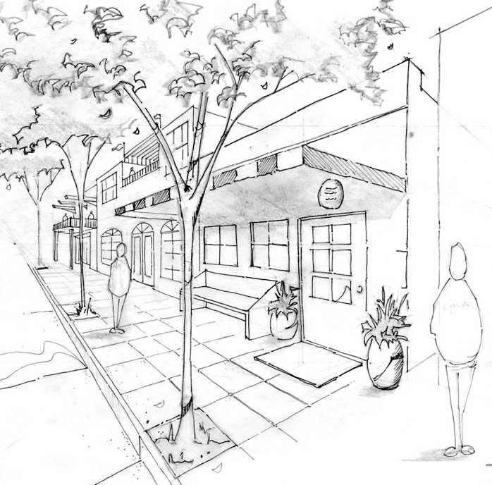
Sections, Perspectives
|
Focus designs need many drawing to illustrate the details of the designs, the selection of materials and the character of the design proposals.
|
|
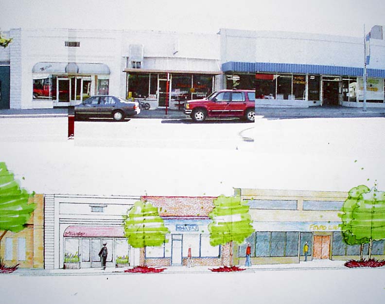
Design Simulation
|
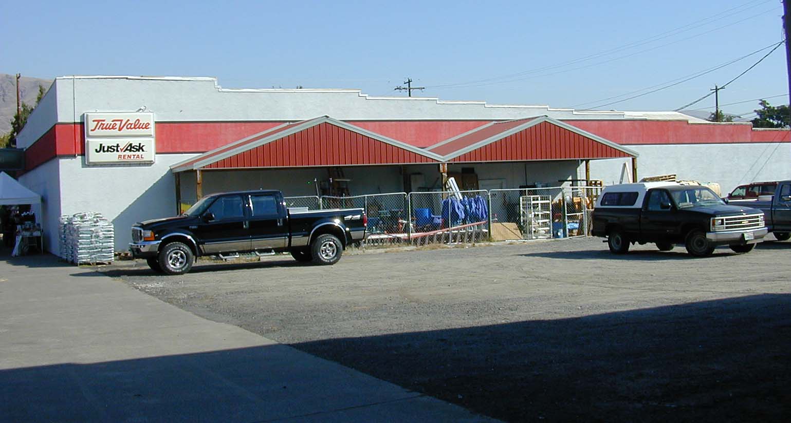
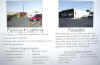
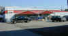
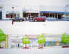
Especially in downtown revitalization projects images of the exiting conditions and simulations of the scene after the design intervention, create compelling and easily understood presentations for a non-design audience.
In these images an equipment rental business in McCall Idaho is presented as a prototype of facade and landscape improvements that could be adopted by this and other business owners.
|
|
Digtal Models
|
Digital models are effective when many view of the same area are necessary to illustrate the impact of the design proposal. |
|
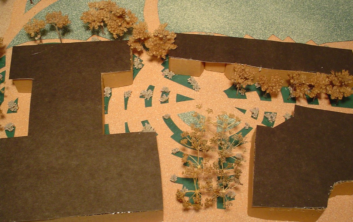
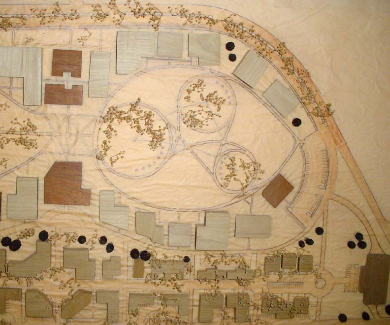
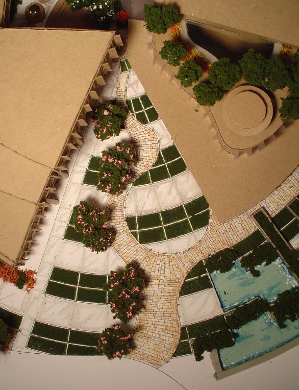
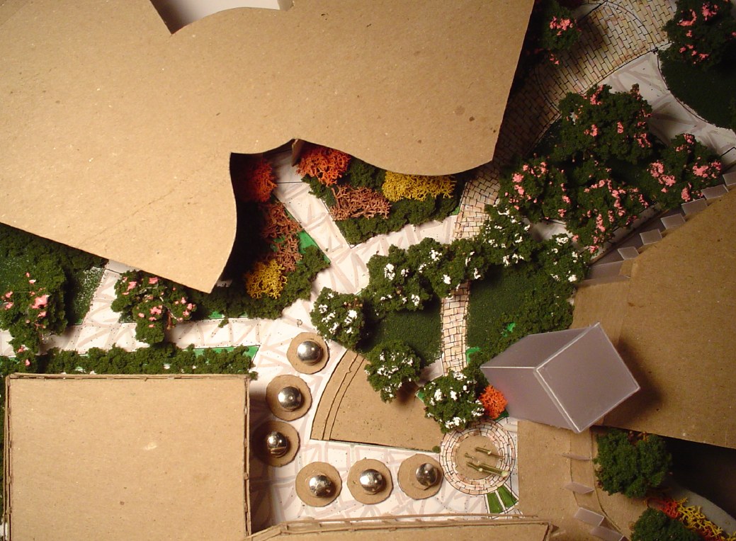
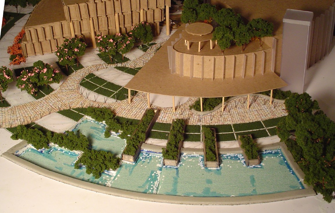
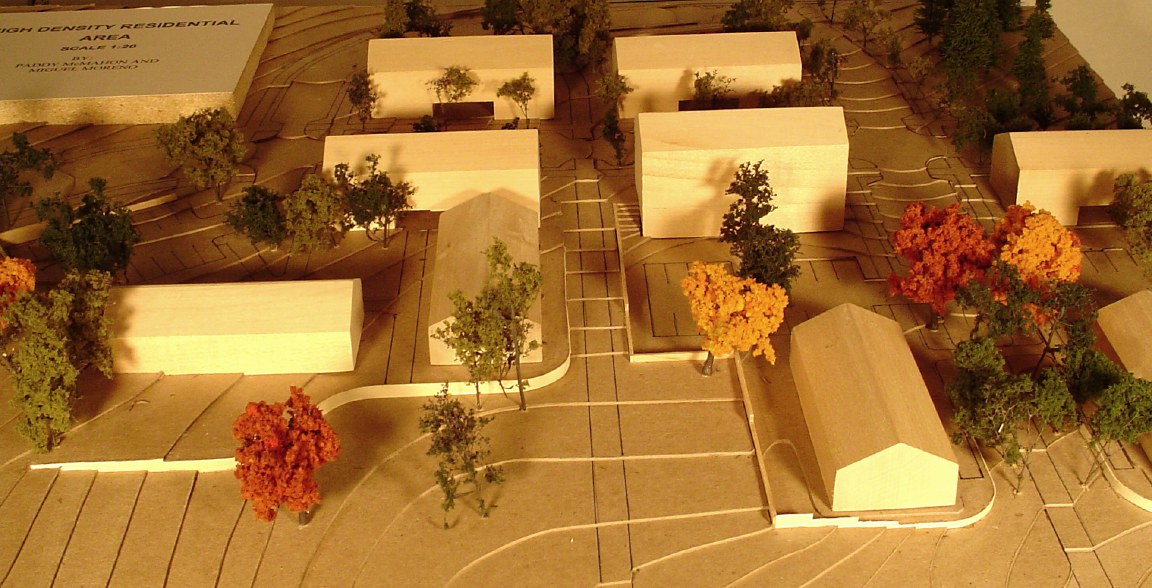
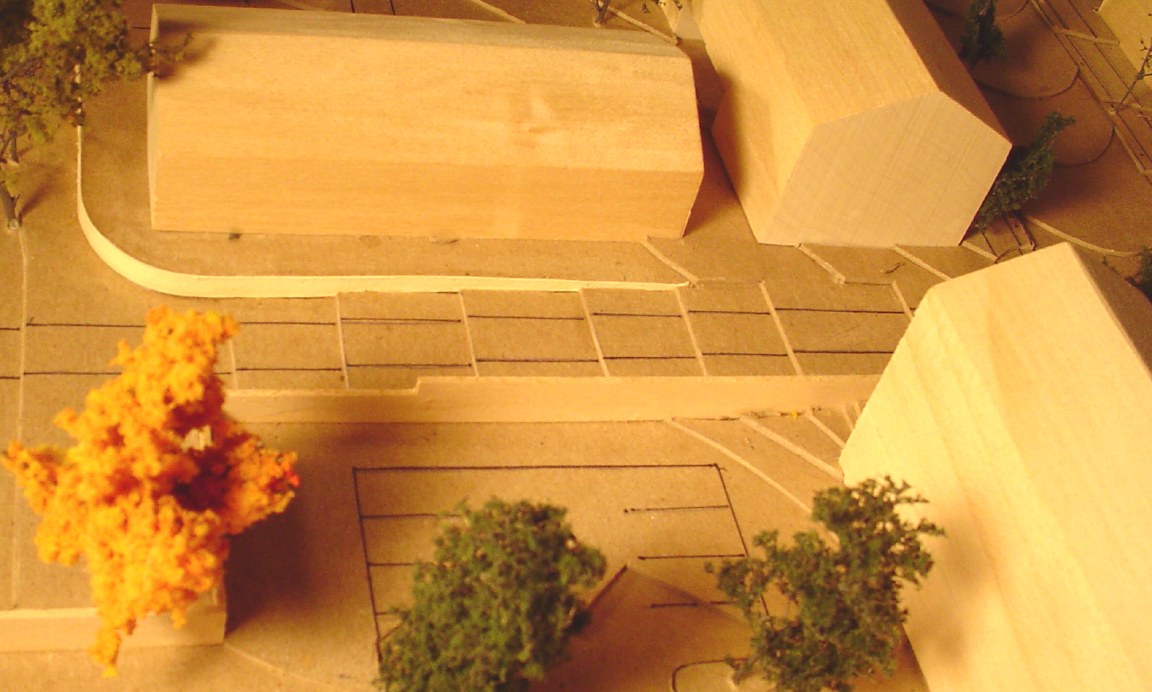
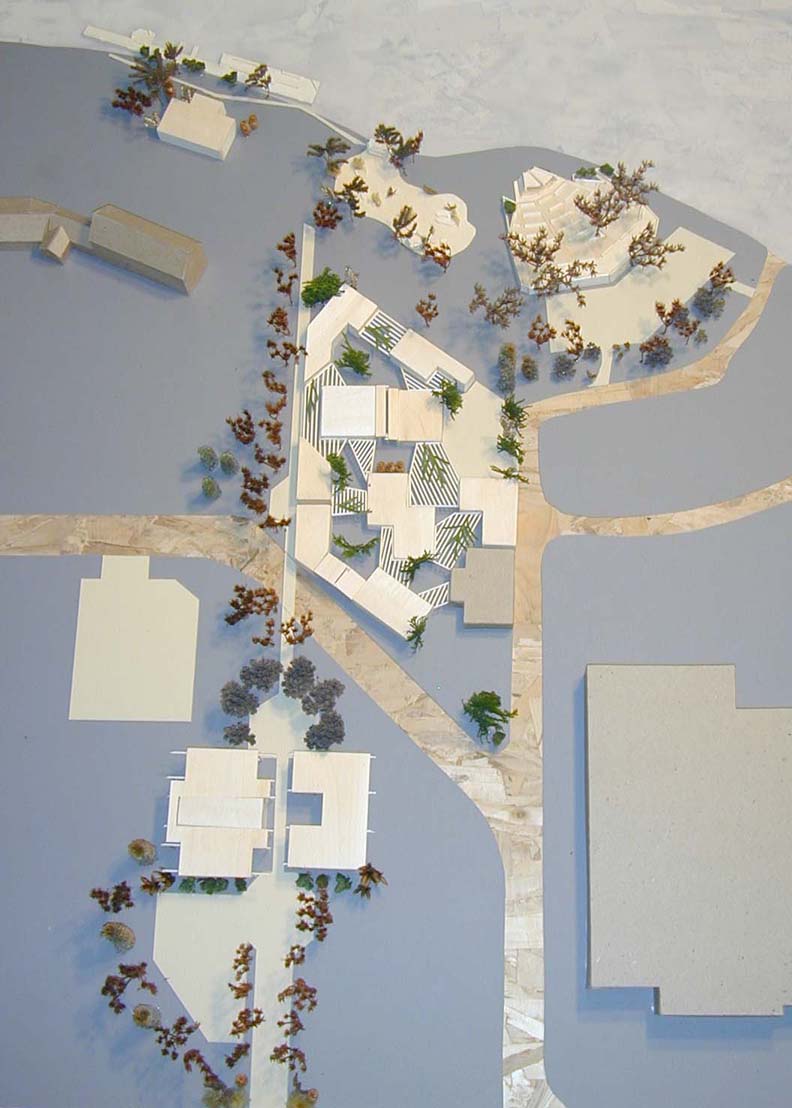
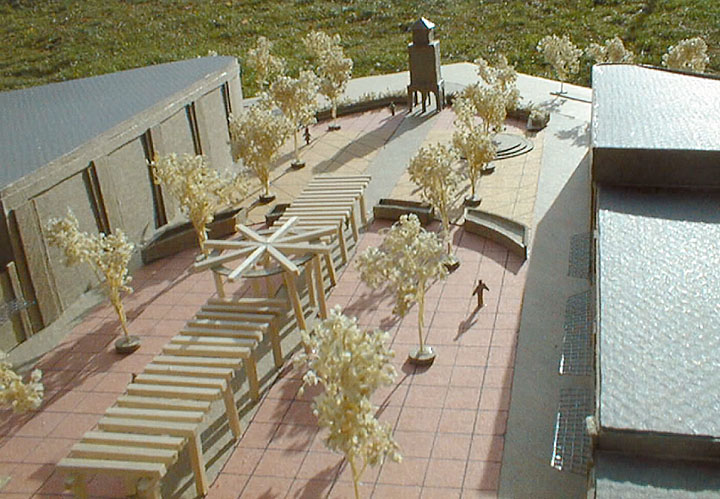
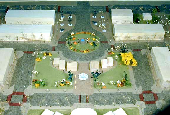
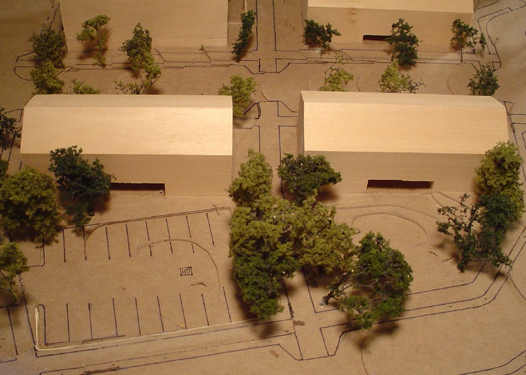
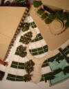
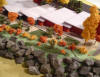
Physical Models
|
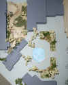
Physical models are great tools for communication existing conditions and design proposals to community groups. The three dimensional aspect of the models make them immediately understood. The models can be used as temporary public displays within the community to garner support for redevelopment or to initiate a dialogue about the future of the town.
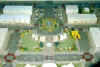
The first image is a model of a proposal for a Port of Clarkston design that would link the downtown to the waterfront.
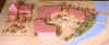
The second image is a model of an urban plaza proposal in Rupert, Idaho.
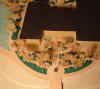
The third image is of a model of a new civic and mixed use district for Star, Idaho.
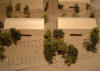
The next model is of a proposal for a riverside commercial district in McCall, Idaho. The Post Falls models are for a business and technology park. The model is unusual in that the land form is modeled in foam while the proposed landscape plan is drawn on tissue and placed over the foam. Buildings and plants are added to the tissue.
Clarkston |
Post Falls |
Post Falls |
 |
 |
 |
 |
 |
 |
| |
|
|
|

Clarkston

Rupert
Star
McCall
|
| |
|