| |
|
Main Menu |
|
|
|
Collaboration |
Your faculty value the opportunity to collaborate and believe this kind of interdisciplinary effort is necessary for the best community planning and design solutions. Therefore, they ask that you adopt the goal of forming effective interdisciplinary partnerships in this course and in your professional career.
Demonstrate Teamswork! |
|
|
|
Welcome |
Density
| |
As mentioned elsewhere, the density required to sustain mass transit is greater than the single family housing levels of 4 to 6 units per acre. Therefore, single family housing is really an auto oriented housing type. This housing will be preferred by many people if their income is high and other factors make suburban living acceptable. To develop a sense of community, to support neighborhood commercial enterprises and to support public transportation a mix uses and housing densities is necessary. Achieving a net density of about ten unit per acre is desirable especially near transit stops and neighborhood commercial.
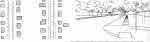
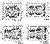
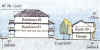
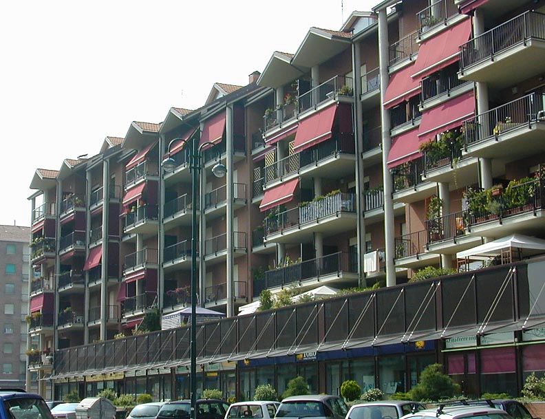
The images at left provide a visual reference in plan and perspective for understanding density. Very low density (1to 6 DU/Ac) toleads to auto dependence and loss of agriculture and forest lands while very high density (50 - 125 DU/Ac).
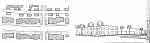
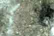
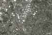
The last two images are aerial photographs at the same scale. The images are of two towns with the same population. The first images is of Moscow, Idaho. Notice that the images does not show the entire developed area of the city.
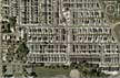
The second images is of Acqui Terme, Italy. In this image all of the developed area and even some of the open space and agricultural land are visible.s |
Single Family Housing
Two Story Attached Housing
Three Storey Attached Housing
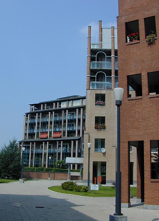
Elevator Building
Mixed Density Housing
Be able to list the densities in units per acre for the following housing types: single family, row houses, 3 story apartments with surface parking, high rise towers with underground parking.
|
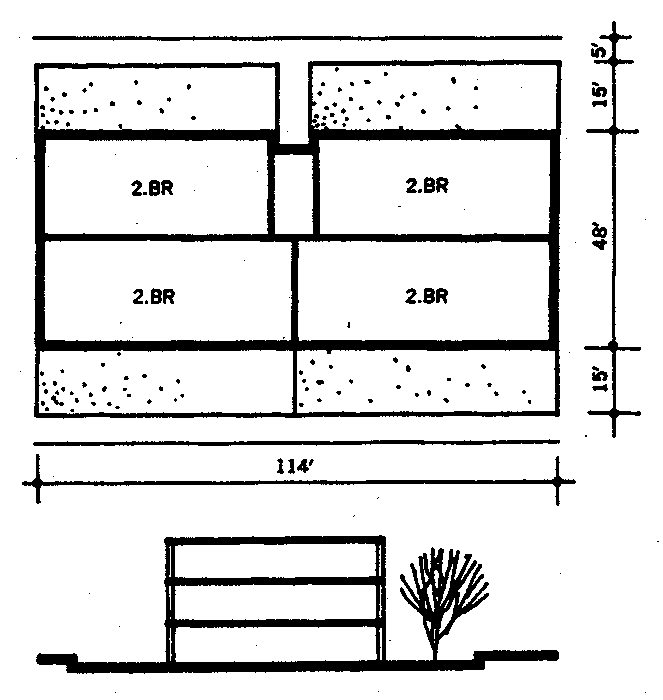
Town Houses
|
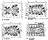
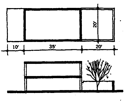
 This plan utilizes two story townhouses. The lot area is 535' by 270' (3.3 acres). There are 20 units per acre (66 total units) with above ground parking for 83 cars (1.25 per unit). The units are 700 square feet each. The yards are 600 square feet. 25% of the site is dedicated to circulation and open space. This plan utilizes two story townhouses. The lot area is 535' by 270' (3.3 acres). There are 20 units per acre (66 total units) with above ground parking for 83 cars (1.25 per unit). The units are 700 square feet each. The yards are 600 square feet. 25% of the site is dedicated to circulation and open space.
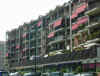
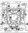
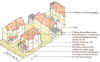
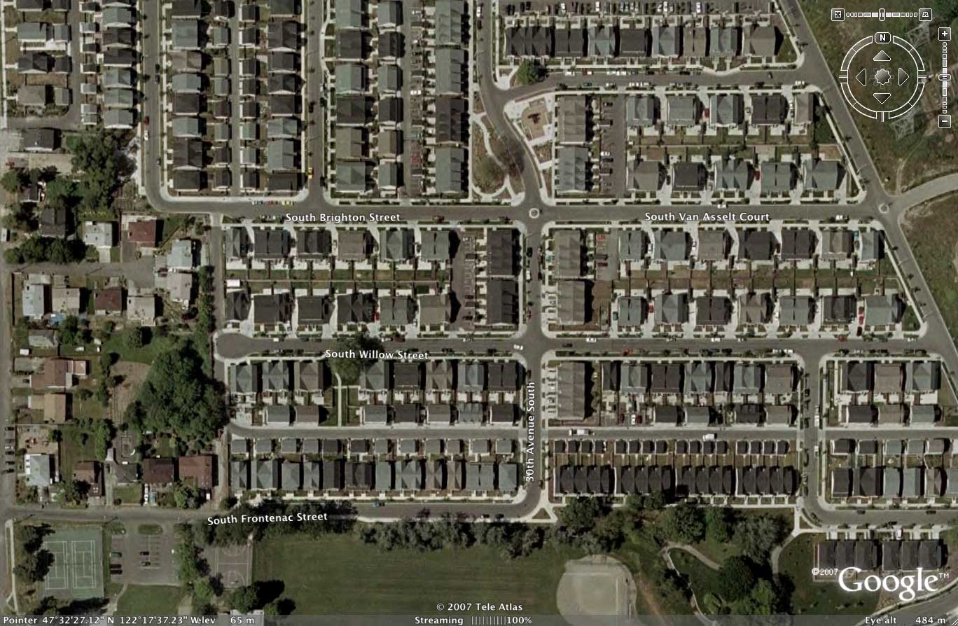
The image below is of the New Holly neighborhood in Seattle. Row houses and other attached housing types result in a density of 15 to 20 dwelling per acre.
 (Google Earth, 2007) (Google Earth, 2007)
|
Plan
|
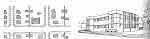
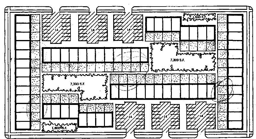
Apartments
|
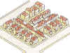
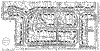
 This plan features three story walk-up apartments. The lot area is 535' by 270' (3.3 acres). There are eight buildings of 12 units each for a total of 96. Each unit is 460 square feet and the ground floor units have a small patio. The density is 30 units per acre. Circulation and open space amount to 25% of the site. This plan features three story walk-up apartments. The lot area is 535' by 270' (3.3 acres). There are eight buildings of 12 units each for a total of 96. Each unit is 460 square feet and the ground floor units have a small patio. The density is 30 units per acre. Circulation and open space amount to 25% of the site. |

Plan
The density represented by this plan and type of development approaches the desired maximum for housing with surface parking
|
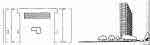
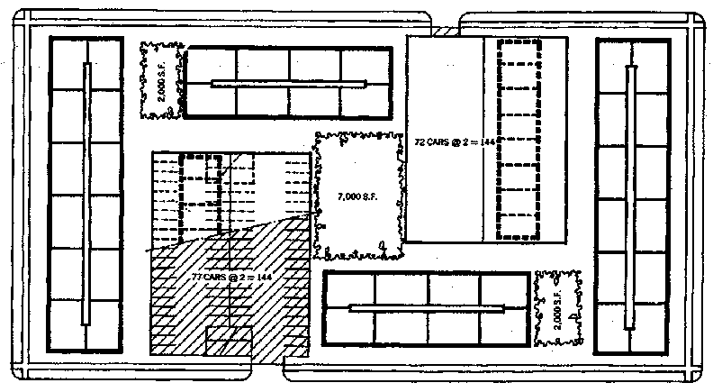
Six Story Building
|
 This scheme includes six story apartment buildings with 40 units per building for a total of 240 units. This figure is reduce by two units per building to account for lobbies for an adjusted total of 232 units. The resulting density is 70 units per acre. The parking is on two levels accommodating 290 cars ( 1.25 per unit). The top of the garage structure serves as plaza or recreation space. This scheme includes six story apartment buildings with 40 units per building for a total of 240 units. This figure is reduce by two units per building to account for lobbies for an adjusted total of 232 units. The resulting density is 70 units per acre. The parking is on two levels accommodating 290 cars ( 1.25 per unit). The top of the garage structure serves as plaza or recreation space. |
Plan
|
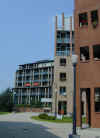
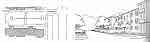
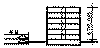
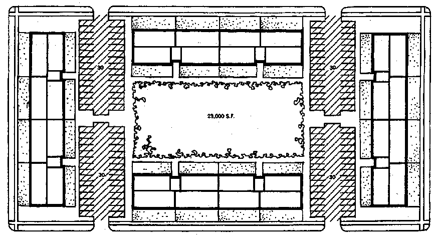
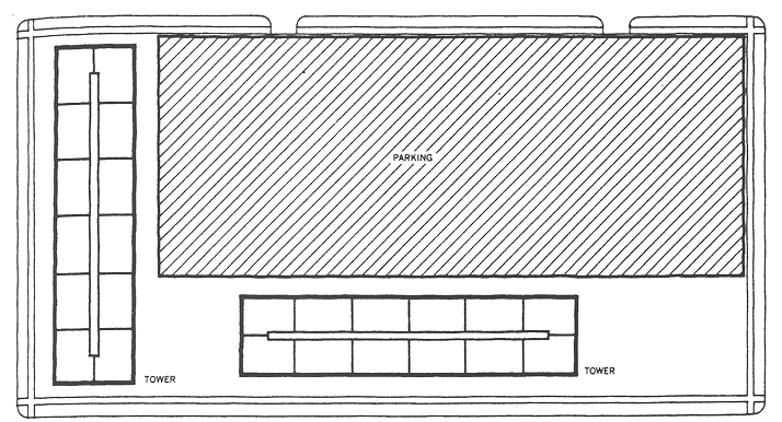
Ten Story Buildings
|
The site is 3.3 acres. One level of underground parking for 300 cars (1.25 cars per unit) is indicated by the shaded area. There are 120 units per building for a total of 240 units. The resulting density is 72 units per acre. |
Plan
|
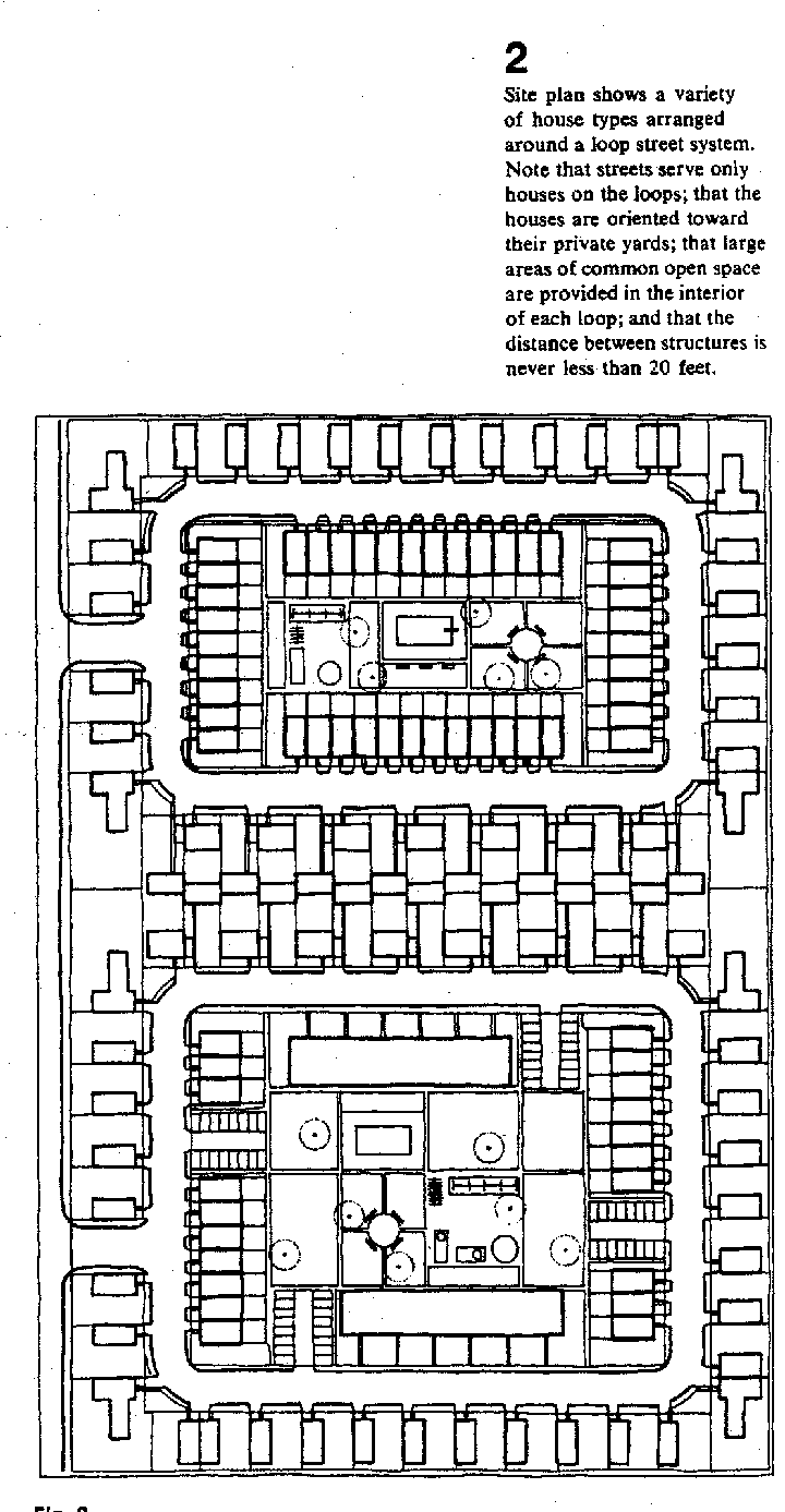
Cul-de-sac Development
|
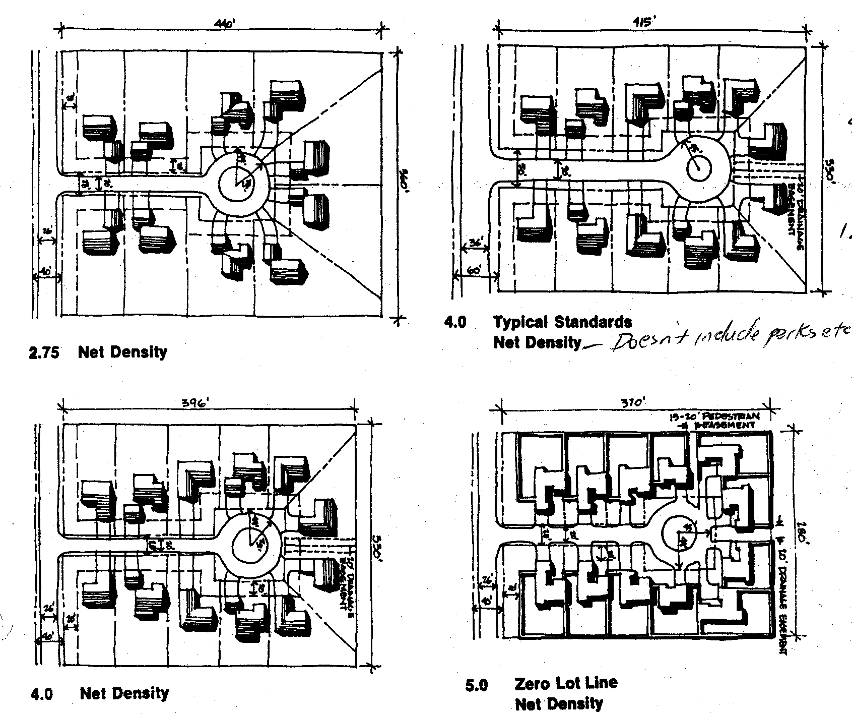
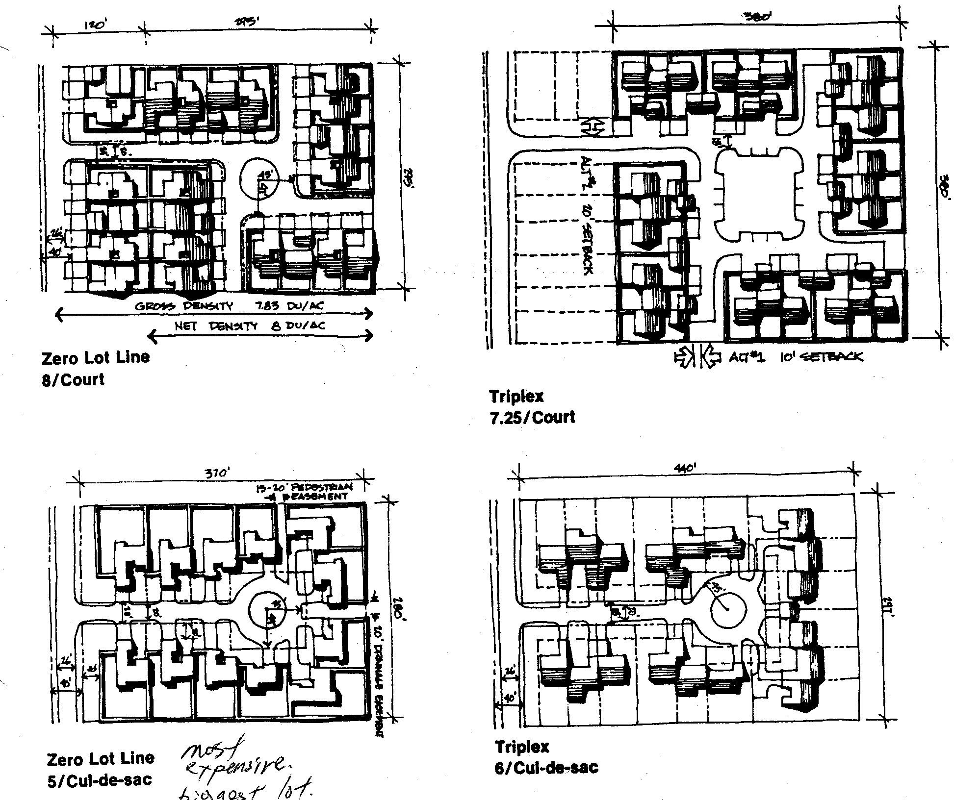
Theses plans are based on the need for a private yard in a suburban. The resulting densities are too low of effectively support mass transit (except) park and ride options. |
|
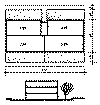
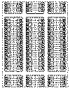
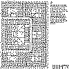
Size/Density Comparison
|
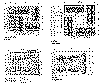
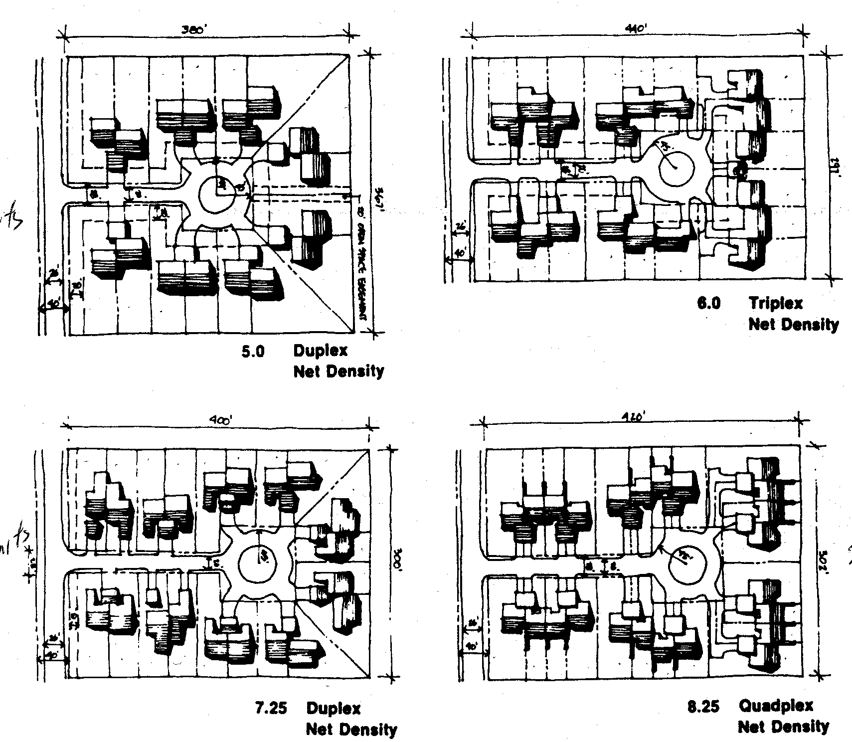
The images at left show a variety of single family development patterns or attached housing with private yard. The table compares designs according to several measures. An estimate of seven to ten units per acre to support mass transit systems illustrate the marginal application of most of the designs to urban centers.
| |
Duplex |
Duplex |
Triplex |
Quadplex |
| Square feet per unit |
2440 |
2200 |
1800 |
900 |
| Average lot size |
7854 |
4888 |
6375 |
4628 |
| Off-street parking |
4 |
2+ |
2 |
2 |
| Minor Street width |
20 |
20 |
20 |
20 |
| Minor street right-of-way |
28 |
28 |
28 |
28 |
| Street pavement per dwelling |
761 |
615 |
715 |
535 |
| Linear feet of street per dwelling |
36 |
30 |
34 |
25 |
| Curbs and gutters per dwelling |
68 |
55 |
63 |
47 |
| Density |
4 |
7.25 |
6 |
8.25 |
|
| Table
Be able to draw the plan for an auto-court development with a density of 7.25 units per acre |
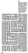
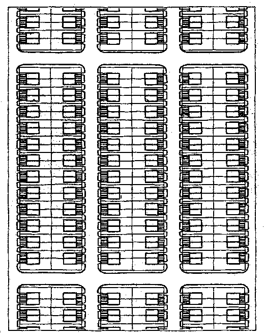
Duplexes
|
Maximum site utilization with semi-detached houses with no open space and straight street grid. The distance between pairs of units is 13'. The gross site area is 20 acres. There are 198 dwellings of 1,400 square feet each. The density is about 10 units per acre.
|
|
Plan
|
Mixed Density
|
This plan mixes single family housing, duplexes and row houses. Some public open space is provided for the row housing sections. |
Plan
|
Townhouse Development
|
This plan features townhouses arranged in clusters. Small private outdoor spaces are provided. Public open space is provided to each housing group with access through the private open space. |
Plan
|
Townhouse Development
|
This is another version of a townhouse development. It utilizes a typical city street grid making it a part of the fabric of the city. However, the grid is modified to eliminate through traffic routes that would encourage higher traffic volumes and speed. |
|
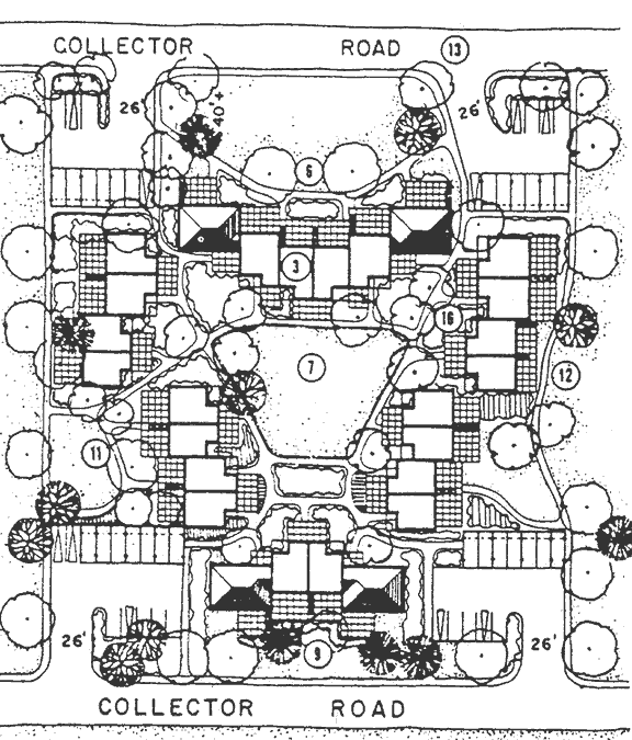
Cluster Developmement
|
This plan groups pairs of duplexes into a cluster. Open space and exterior views. A series of these cluster developments could include interior parks. Access from two collector roads is a positive aspect of the plan. Private garages or carports are efficiently grouped near the collectors. The density is about 6 units per acres. |
Plan
|
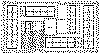
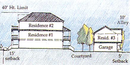
Three Units per Lot
|
This development provides for a compact development development pattern while providing semi-private outdoor space and garages. Enlarge the section first to discover how the dwelling s are distributed. Each cluster of three units and the garage are shown in the second image. The last image shows how the clusters would be distributed in a large development. Images are from The New Urbanism by Peter Katz
|
Section
Be able to draw the section above from memory and indicate the density.
Guidelines
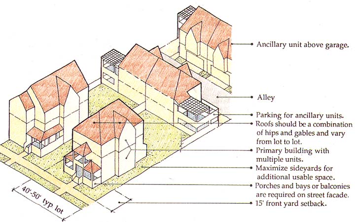
Development
|
Townhouse Group
|
This townhouse cluster groups units in a way that breaks the typical row house impact. Garages are included under two stories of living space. The units are tall and narrow. The density of this pattern is quite high if large private yard are not provided.
|

Elevation
|
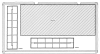
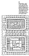
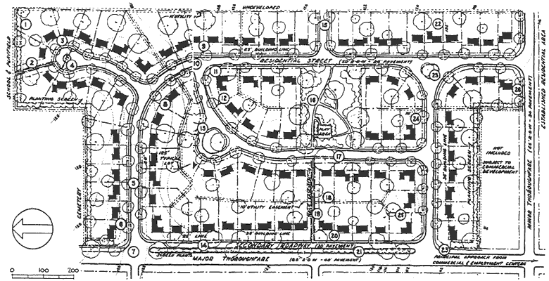
Subdivision
|
This is a well designed single family residential subdivision. It is the model of much suburban development in the United States. The disadvantage of this model, and many of the examples above, is the single use. No commercial retail or office uses are included in the development. The combined impact of many of these subdivisions adjacent to each other is that residents are entirely dependent on the private auto to gain access to shopping and work. Mass transit can not serve subdivisions like this because the density is to low to justify the cost of the transit system. |
Plan
|
|
|
Past Projects of This Studio |
We have contributed to the positive planning and design efforts of many communities during the ten years that this combined studio has been doing outreach work. We have worked in these Idaho communities: Orofino, Riggins, Grangeville, Harrison, Hayden, Sandpoint, Lewiston, Star, Rupert, New Meadows, McCall; these Washington communities - Clarkston ; and these Montana communities - Seeley Lake.
|
|
|
|
|


