| |
|
Main Menu |
|
|
|
Collaboration |
Your faculty value the opportunity to collaborate and believe this kind of interdisciplinary effort is necessary for the best community planning and design solutions. Therefore, they ask that you adopt the goal of forming effective interdisciplinary partnerships in this course and in your professional career.
Demonstrate Teamwork! |
|
|
|
Welcome |
Open Space
Study Questions for Open Space are highlighted in blue in the left column.
- This page includes the following sections. Click on thumbnail images for an enlarged image in a new window.
Open space
Access
|
Included among the human aspirations is the desire for open space and outdoor recreation opportunities where individuals and families can exercise, play, experience nature, and socialize with neighbors. Open space should be planned as a structural element of the region, city and neighborhood.
Usable open spaces are those areas that are inviting and encourage use by the surrounding community. Open space that is only a visual amenity, such as agricultural land, may be very important to the community. Open space can include one or more of the types listed below:
- Lanes
- Playgrounds
- Nurseries
- Close
- Public plazas - located in civic centers or in mixed use neighborhoods including the market plaza and civic plaza
- Green space - including the green, the park, and the buffer
- Recreational space - sports fields, recreational trails
- Agricultural land
Open space has value as a visual amenity. Farm land and protected wildlife refuges are of this type. But in the urban context it is generally for public or semi public use. Open space is not usable if the surrounding streets are unsafe or intrude on the the space. Accessible auto, bike and pedestrian routes increase the use of outdoor spaces. Equally, green space is not usable if it is overrun by weeds or if the planting is too dense. Dense plantings prevent sight lines and adequate light infiltration, and therefore reduce ones sense of safety. Having access to an adequate amount of green space is useful for active enjoyment with a pet. Public plazas are not always appropriate places to bring a pet, as they are usually paved, more formal and highly populated.
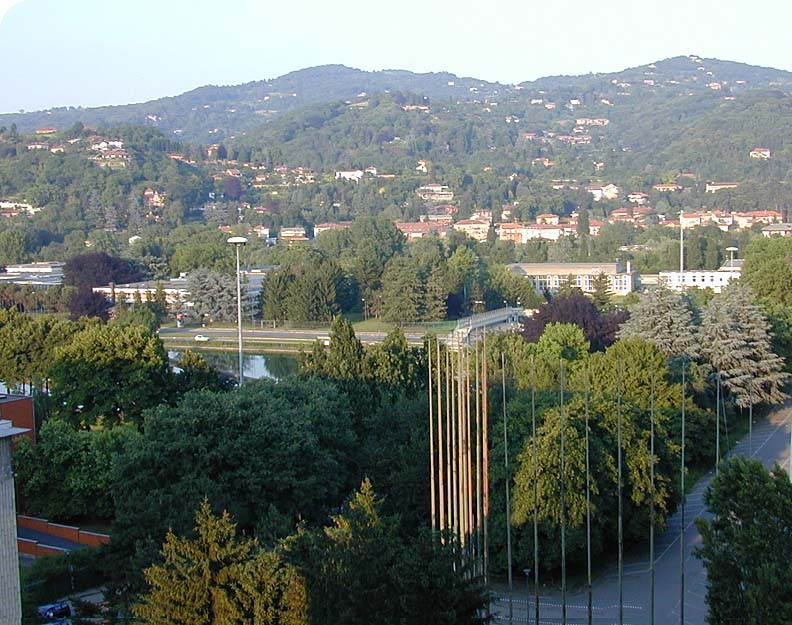
The National Recreation and Park Association (NRPA) has developed a set of recommended park and open space planning standards. Generally, NRPA, recommends a minimum of 6.25 to 10.5 acres of developed open space per 1,000 population.
|
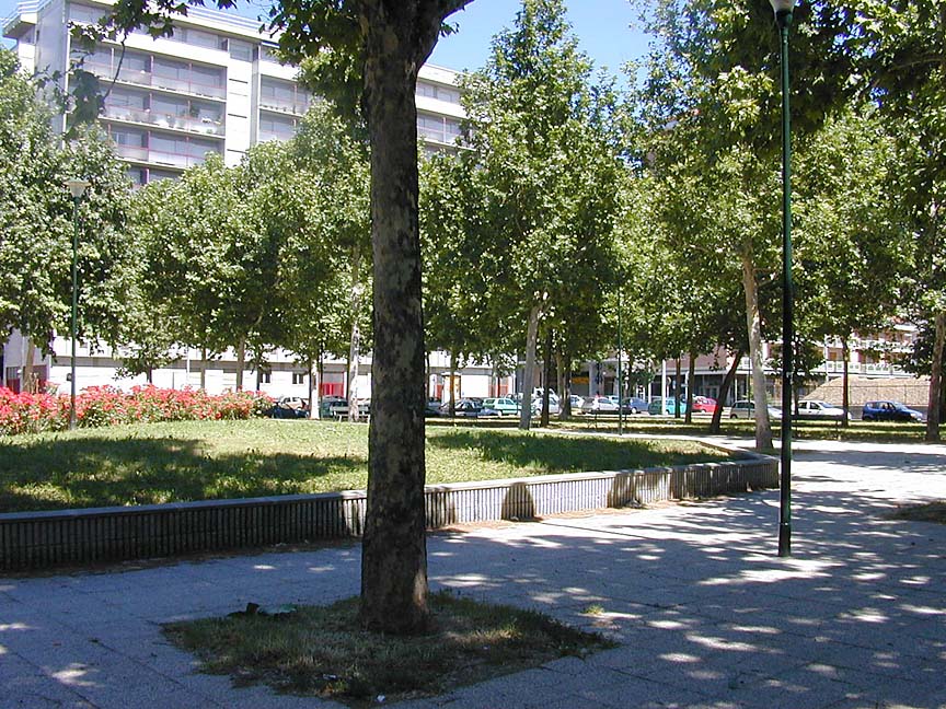
(Austin, 2000)
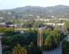
This image was taken from a 9 story residential condominium. This density is a joy when there is direct access to the parks, river trails and athletic fields visible in this scene.
What is the minimum standard for community open space set by the National Recreation and Park Association?
|
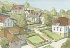
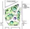
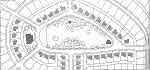
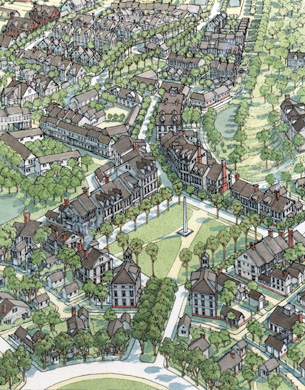
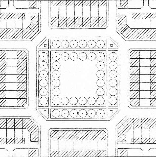
Green Infrastructure
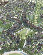 Mashpee Open Space System (DPZ, 2007) Mashpee Open Space System (DPZ, 2007)
Define "Green Infrastructure" and list two of its components.
|
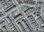
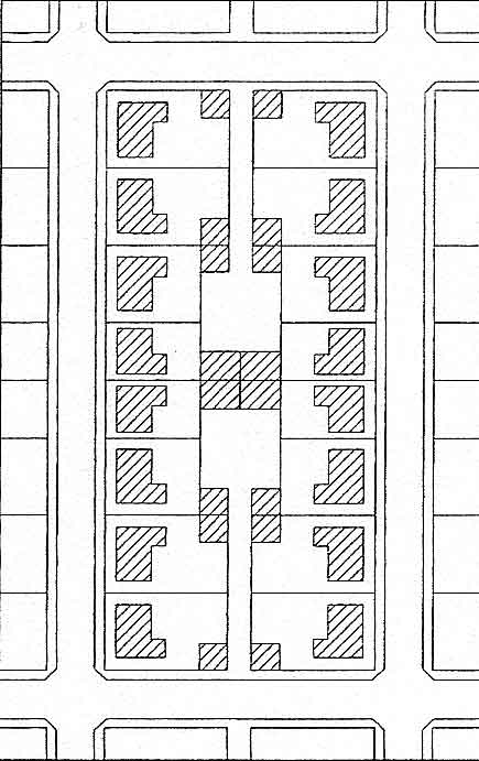
In the unit on Physical Urban Design town plans, neighborhood plans, block types and building types were presented but without much consideration of the open space that should be associated with them. For residential development on small parcels open space is an amenity for the residents especially as the dwelling density increases. For multi-family housing developments, public open space should be considered the resident's reward for living in higher density and should be required by city ordinance. For example projects with 8 to 20 dwelling units per acre might be required to contain 10% to 30% public open space.
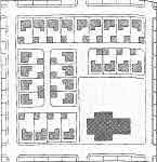
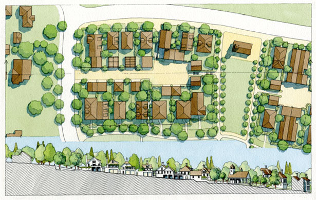
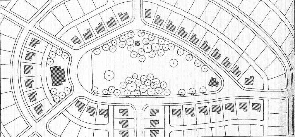
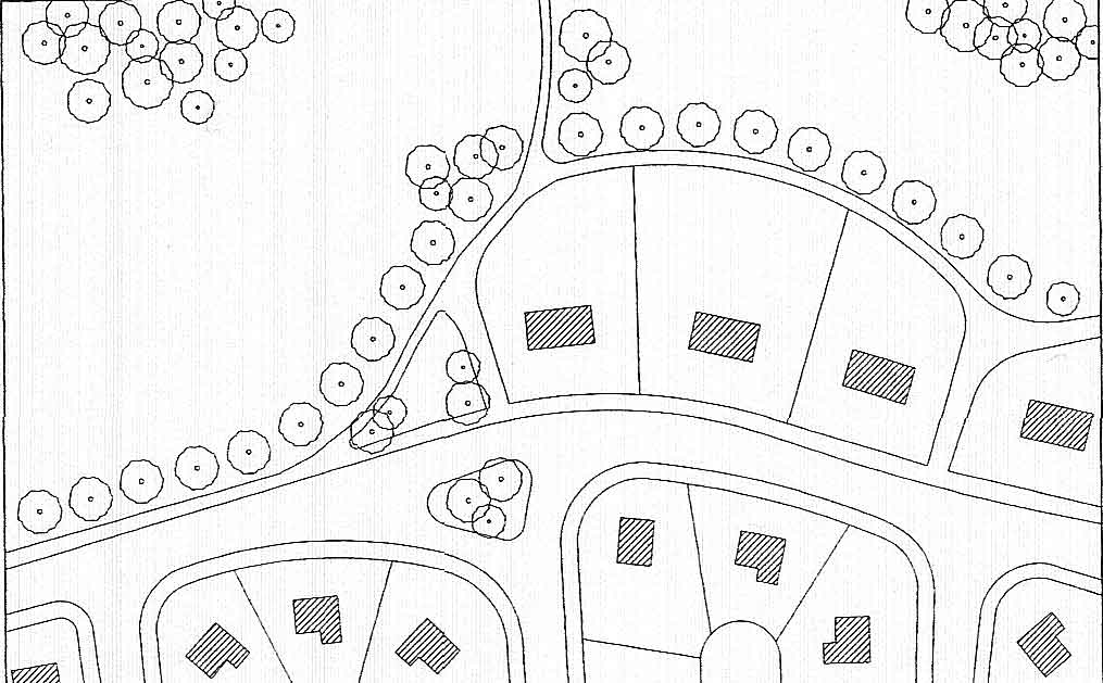
Many of the images below consider open space within the context of individual block (elongated block are used for illustration purposes). This does not mean that open space systems should not be planned at the community and regional scale. To be most effective and useful to residents and even wildlife an open space system of corridors connecting nodes of parkland requires a citywide approach with links to regional systems. Sometimes called Green Infrastructure this planning approach is especially important where environmentally sensitive lands are present within or adjacent to the city.
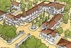
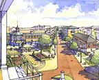
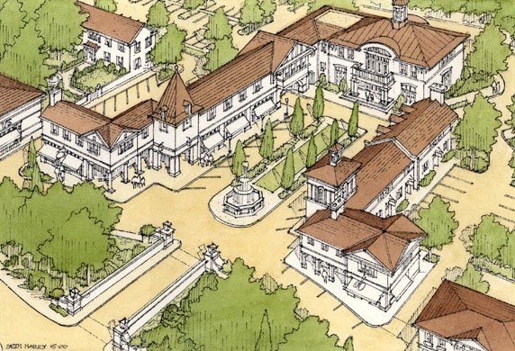
The perspective at left illustrates and wide range of open space types. Enlarge the image and note that the open space structures the commercial and high density housing areas in the most urban neighborhoods and serves as recreation and connections to the region in the lower density residential areas.
|
| Lane |
|
Lane (Hooper, 2007)
|
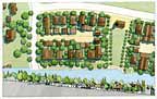
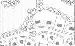
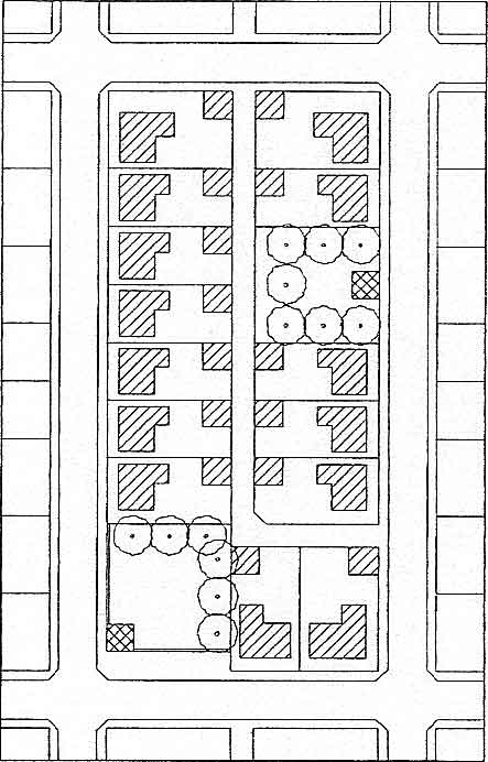
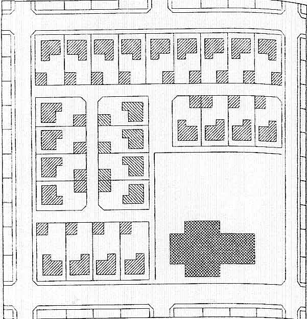
The plan at left shows a truncated lane and auto court in the center of the block. These are popular places for ball games and wheeled toys. The lane is a much safer location for these activities than street side locations.
The plan and perspective of Westmont, below, illustrates the use of the lane in the context of a village housing plan. Note the response to the existing topography that is apparent in the perspective but not in the plan in the images below. Enlarge the images and estimate the density of this block.
The National Recreation and Park Association (NRPA) might define the lane as a Mini-Park. These parks are specialized facilities that serve a concentrated or limited population or specific group such as tots or senior citizens.
Service area: Less than 1/4 mile radius
Acres per 1,000 population: 0.25 to 0.5 acres
|
Lane at Westmont (DPZ, 2007)
|
Lane at Westmont (DPZ, 2007) |
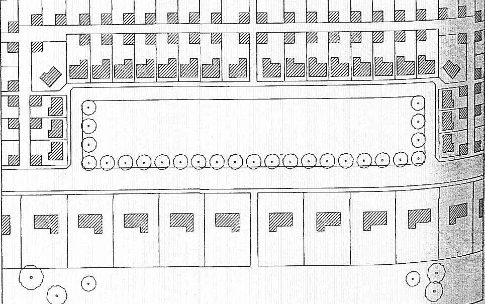
Playground
|
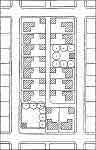
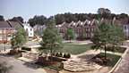
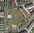
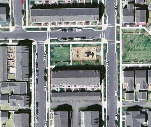
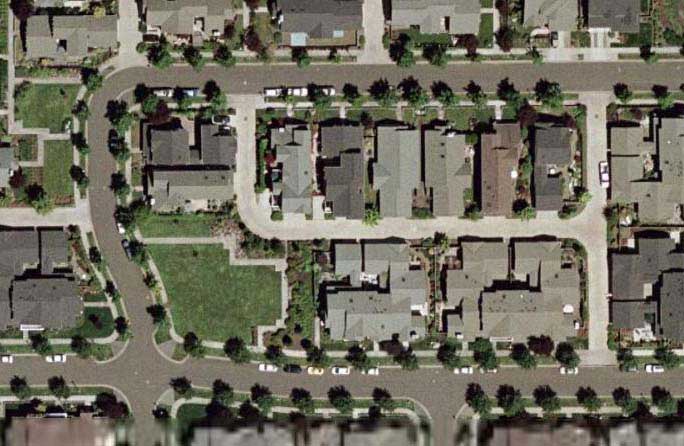
Playgrounds should be within 500 feet of any residence in the neighborhood. They can be easily accommodated in the subdivision lot pattern. Enlarge the aerial photo and note the use of the end of the elongated block as the playground location. Also, note that the highest density housing is adjacent to the public open space.
Playground at the Kentlands (DPZ, 2007)
The area shown in the image above is a little too small but NRPA might define the playground park a Neighborhood Park. These are the basic units of a park system and typically provide for both active and passive recreation activities. The service area should include the entire adjoining neighborhood. In addition to play apparatus for pre-school and school age children, facilities are likely to include open lawn and paved court areas, shelters, wading pools, outdoor ice rinks, and some off-street parking. Trees, open fields, and undeveloped natural areas are also desirable components of neighborhood parks.
Service area: 1/4 to 1/2 mile radius to serve a population 1,000 to
5,000 persons
Desirable Size: 5 – 10 acres
Acres per 1,000 population: 1 to 2 acres
Desirable site characteristics: Suited for intense development. Easily
accessible to the neighborhood population. Geographically centered
with safe walking and bike access. May be developed as a school-park facility. |
Playground (Hooper, 2007)
Each residence in a neighborhood should be within how many feet of a playground?
|
Nursery
|
Each neighborhood should offer high quality child care. Note that little parking is required but an ample drop-off lane is necessary to avoid congestion in the street.
In this plan the day care facility is integrated into the fabric of the neighborhood so that residents can walk there. |
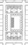
Nursery (Hooper, 2007)
|
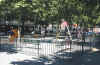
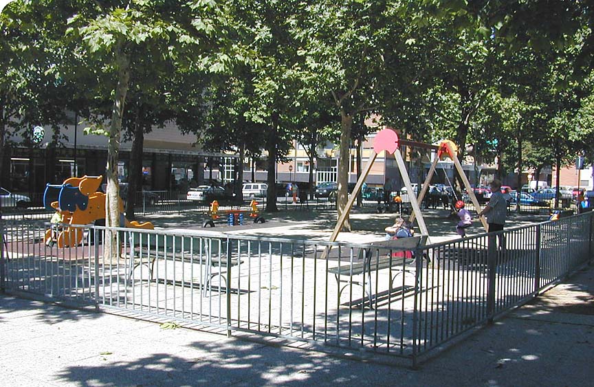
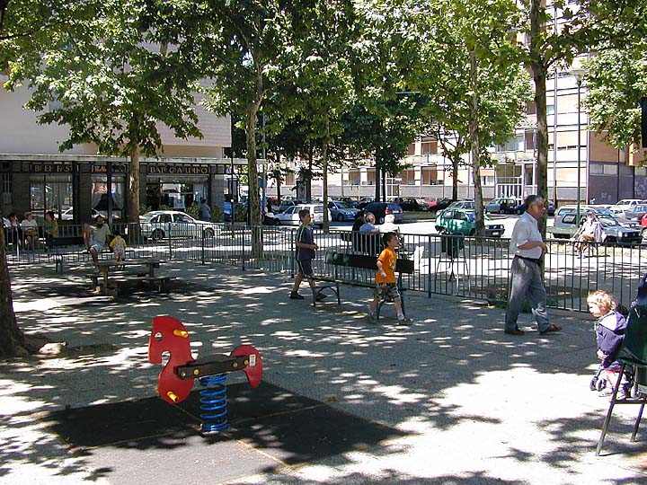
Urban Playgrounds
|
Playgrounds and nurseries provide recreational areas and learning environments for children. In some instances, playgrounds can function both as a resource for residents of the neighborhood and organizations such as schools. Shared spaces are effective in maximizing land use in urban areas.
Safety is the first requirement of playgrounds for toddlers. Protection of the children from vehicular traffic is most important.
The space should include areas where parents can observe the play and socialize with other parents. Enlarge the images at left and identify the features that make it a successful amenity. |
 (Austin, 2000) (Austin, 2000)
Toddlers Play Area
 (Austin, 2000) (Austin, 2000)
Toddlers Play Area
|
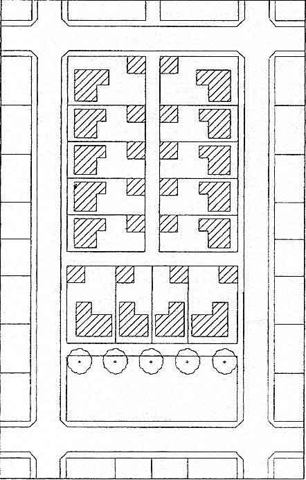
Close
Close (Hooper, 2007)
Define what a Close is and why its preferred over a cu-de-sac. |
A close is similar to a cul-de-sac but is better integrated into the traditional neighborhood. This image illustrates that the close (at the bottom of the plan) has a planted center and serves as a neighborhood amenity. In this case the close is at the front of the houses retaining the alley access to the garages. |
Attached Squares
|
The attached square is a green space or plaza that is not separated by a street from the dwelling units on the block.
Orinco Station - Attached Square
(Google, 2007)
|
Attached Square
(Hooper, 2007)
|
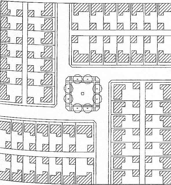
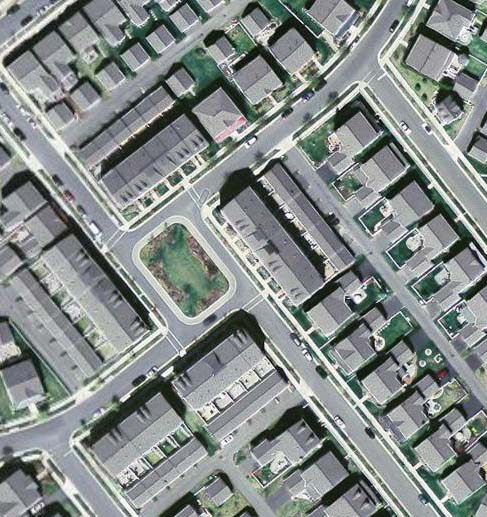
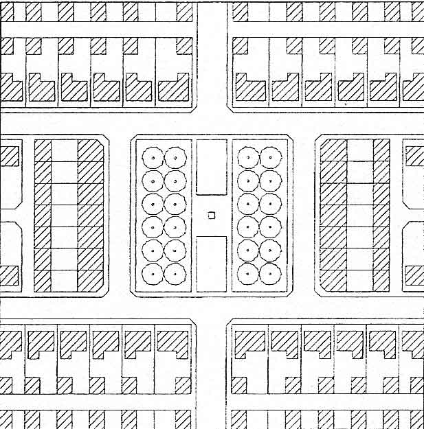
Detached Squares
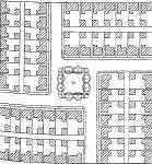 Detached Square - Street Island (Hooper, 2007) Detached Square - Street Island (Hooper, 2007) |
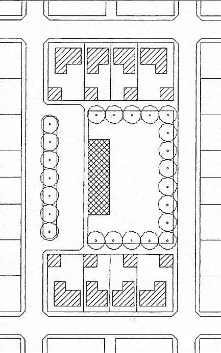
Detached squares are less desirable that attached squares unless they are nearly a block in size. This is because they are bound on all sides by streets. In the first image the square is too small to be an effective use area due to the impact of surrounding traffic and an exposed setting. However, this square is an effective identifier of the neighborhood and a visual amenity.
Detached Square - Kentlands (Google, 2007)
|
 Detached Square (Hooper, 2007) Detached Square (Hooper, 2007)
|
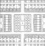
The detached square in the image at left is large enough and well buffered to provide amenities such as athletic courts and passive landscape areas. The square in the image below is in a mixed use area rather than an residential neighborhood. It controls and slows traffic and provides necessary space between the buildings across the square.
Vermillion Detached Square(DPZ, 2007)
|
 Detached Square (Hooper, 2007) Detached Square (Hooper, 2007)
The detached square is sometimes useful only visually and other times as an amenity for active use. Explain positive feature leading to active use.
 (Austin, 2000) (Austin, 2000)
Simple amenities
|
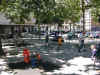
This example of a detached square (left and below)is even more useful as a neighborhood resource. Notice that the pedestrian circulation has been moved away from the curb for a more pleasant and safer experience. Unfortunately, there are few amenities for the residents in this well formed space.
Vickery Square(DPZ, 2007)
The second image at left shows a space that is part urban plaza and part urban park. It is detached from the multi-story buildings by access roads. It received very high use by local residents of all ages.
|
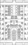
(Southwick, 2000)
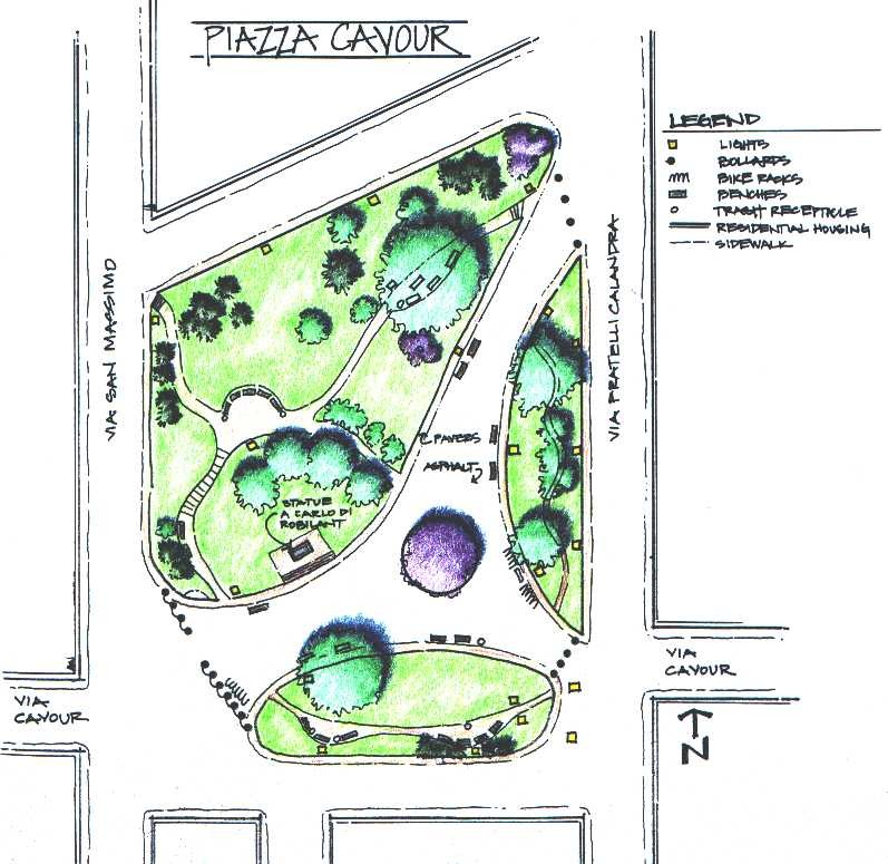
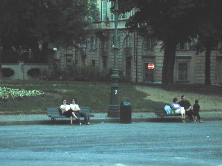
Plan of Piazza Cavour
 (Southwick, 2000) (Southwick, 2000)
Piazza Cavour
|
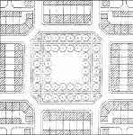
The urban park at left is a detached square in a dense neighborhood of a large city. Parks like this are green spaces contrasting with the paving and hard surfaces of the city streets and buildings. These are oasis spaces. Enlarge and study the plan of Piazza Cavour. It is a pleasant open space that was adapted from a vehicular roundabout. It is surrounded by streets and residential housing. The streets to the north and south have little traffic on them as they are primarily for the residents, while the east and west are quite busy. All of the green spaces are are mounded which lowers the impact of the passing cars, and increases the feeling of privacy.
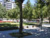
This site is well used. In the second image to the left there are people who are sitting and enjoying the intimacy of the area. There were others who were playing with, or walking dogs. |
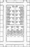
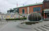
Market Plaza
|
Plazas are associated with commercial or civic functions. In the European tradition the space is designed and enclosed as a pedestrian plaza but serves as parking when the market is not active. This often means that parking is allowed each afternoon after the open air market closes or alternatively two or more days each week are dedicated to the market use. In this diagram (left) the suggestion is that the market plaza is an integral park of the residential neighborhood not separated from it in a commercial zone. Below an attached plaza is the setting for a public building. It has ample unperformed space for temporary use as a market.
Kentlands - Attached Market Plaza
(DPZ, 2007) |
 Market Plaza Market Plaza
(Hooper, 2007)
|
Civic Plaza
|
Civic plazas are the celebration spaces associated with civic buildings. Like the building they present the finest design and materials possible as a expression of community pride. Often the space is made primarily of paved surfaces and not highly programmed with permanent elements since it must be flexible enough to serve a wide range of community events. The image below is of the Pioneer Square in Portland, Oregon. It is very successful as an urban civic space although it doesn't include a municipal government building on its edge. This was an urban redevelopment project that added much needed open space to the shopping and financial district.
Pioneer Square, Portland (Austin, 2006)
|
 Civic Plaza Civic Plaza
(Hooper, 2007)
|
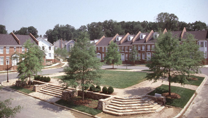
Green
|
The green is an informal park surrounded by housing. In the image at left the dwellings are single family housing with a community center. Residents with large private open spaces are not heavy users of public open space. Therefore, it is often desirable to place the highest density housing adjacent to the public green since little private open space is available.
Orinco Green (Google, 2007)
|
 Green (Hooper, 2007) Green (Hooper, 2007)
|
Park
|
Parks are community or even regional resources. The often provide for many uses including wildlife habitat.
According to NRPA a Community Park is an area of diverse environmental quality. May include areas suited for intense recreational facilities such as athletic complexes and large swimming pools. May be an area of natural quality for outdoor recreation, such as walking, viewing, sitting, and picnicking. May be any combination of the above, depending on the site and community need. Desirable facilities in community parks included those listed above in neighborhood parks, along with swimming facilities, lighted ball fields, and tennis courts, a community center, and adequate off-street parking. It is important that community parks be located on or near major thoroughfares, and also be easily accessible by foot. Landscaping and natural areas are desirable in a community park.
Service area: Several neighborhoods, 1 to 2 mile radius.
Desirable Size: Over 10 acres with 15 to 40 acres being most common.
Acres per 1,000 population: 5 to 8 acres
Desirable site characteristics: May include areas such as water bodies, and areas suited for intense development. Easily accessible to neighborhood served.
|
 Park land (Hooper, 2007) Park land (Hooper, 2007)
|
Buffer
|
Buffers are open spaces that are needed when conflicting land uses are adjacent. The most common applications are separators between commercial and residential or between arterial roads and residential. |
 Buffer (Hooper, 2007) Buffer (Hooper, 2007)
|
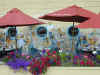
Spatial Character
|
Also important in the design of urban open space are a sense of arrival, mystery, variety in plantings, and developed planes of space. The three planes of space are important components that give dimension to designed environments. Tree canopy provides for overhead plane as well as vertical plane, and a variety in plantings and paving contribute to aspects of the ground plane. Surrounding buildings and other architectural or sculptural features further contribute to aesthetics and planes of space. The image at left shows a great design utilizing a wall mural and raised planter to define the edges of the space. The top of the space is low to establish an intimate atmosphere while the flowers animate the foreground.
Included in the list below are activities and facilities that help create successful urban open space:
- Bike racks
- Bicycle and pedestrian routes to the site
- Recreational trails within the park
- Trash receptacles dispersed throughout - To keep the park clean
- Adequate seating - Benches and turf areas
- Adequate lighting - for safety
- Plantings should not compromise pedestrian safety
- Planes of space (definition of exterior rooms)
- Limited vehicular access through the space
- Usable green space
- Play areas for small children
|
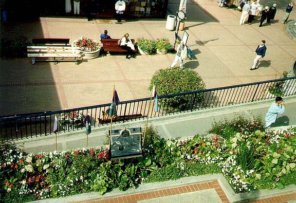
(Austin, 2000)
San Jose, Calif. Dining Area
|
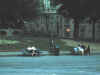
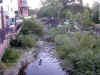
Access
|
Open space must be close to residences in order to best benefit the community. Having to take the tram or bus to get to a park is discouraging. Being able to stroll or walk a dog to the park as opposed to driving to the park is much more convenient. Further, this increases the sense of ownership among neighborhoods. One way to achieve this is by having pocket parks (small frequent parks) located throughout residential areas. Thus, interaction is encouraged between people in the same neighborhood.
In this image of a stream greenway running through San Luis Obispo, Calif. Restaurants and retail business border this corridor that links sections of the city. The corridor also provides habitat for urban wildlife.
|
 (Austin, 2000) (Austin, 2000)
|
Distributed Open Space
|
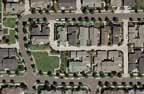
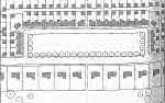
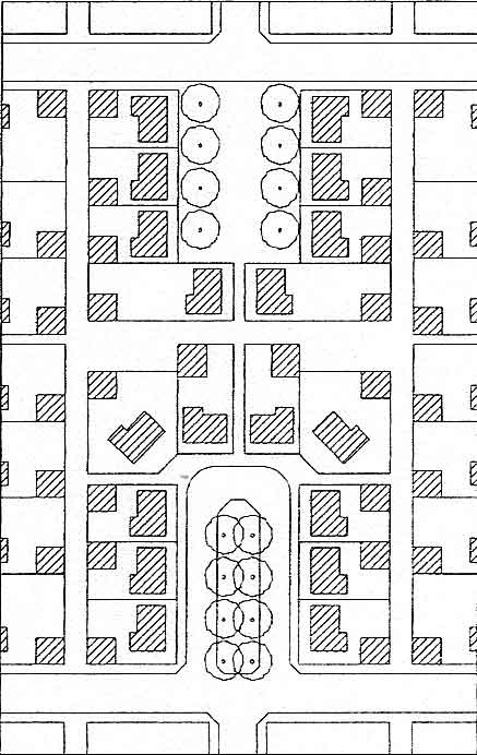
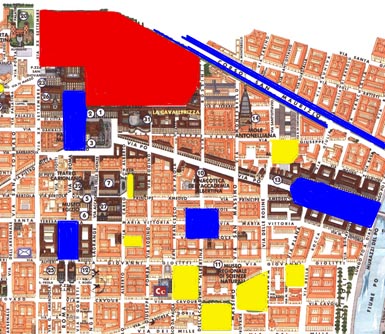
A network of linear parks connecting various sizes of open space is a ideal that is not possible in most existing American cities. Established highways, rail lines and the absence of available corridors or undeveloped space makes retrofitting a community difficult. Most cities compromise by providing distributed open space. In the plan shown here the kinds of open space are identified. City wide parks (red) for recreational activities are not required in every neighborhood, yet they provide a larger range of needs for surrounding communities. Activities such as running, walking, and biking are accommodated. Regional parks are shared among many different neighborhoods which attribute to connection within the entire region. The older city of Turin Italy (shown in this plan) has a remarkable park system. This area of town has some of the highest population density in the city. There are little parks that seem to appear around every corner, many of which are not even shown on this map. Notice that in this area there is an open space within just a few blocks from most buildings. |
 Plan of downtown Turin, Italy Plan of downtown Turin, Italy
red = regional park
blue = urban plaza
yellow = green space
|
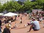
Urban Plazas
|
Public plazas (blue in the plan above) are like regional parks in accommodating use by citizens of the entire city and tourists as well. Smaller plazas can be shared by two or more neighborhoods. The programming of the plaza can vary. Certain plaza spaces can accommodate parking during certain times of the day or week while at other times serving as venues for public events such as markets and concerts. Plaza's bring people together for social interaction. |
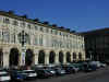
(Austin, 2000)
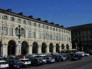
Piazza San Carlo
 (Austin, 1998) (Austin, 1998)
Ghiradelli Square, San Francisco
|
Summary
|
Open space is a necessity for successful communities. Different amenities to provide use by all ages is a must. Usable open space encourages interaction among friends and family at the neighborhood level while also providing a way for people of the region to interact. |
(Austin, 2000)
Oakland, Calif. |
|
|
Past Projects of This Studio |
We have contributed to the positive planning and design efforts of many communities during the ten years that this combined studio has been doing outreach work. We have worked in these Idaho communities: Orofino, Riggins, Grangeville, Harrison, Hayden, Sandpoint, Lewiston, Star, Rupert, New Meadows, McCall; these Washington communities - Clarkston ; and these Montana communities - Seeley Lake.
|
|
|
|
|


