| |
|
Main Menu |
|
|
|
Collaboration |
Your faculty value the opportunity to collaborate and believe this kind of interdisciplinary effort is necessary for the best community planning and design solutions. Therefore, they ask that you adopt the goal of forming effective interdisciplinary partnerships in this course and in your professional career.
Demonstrate Teamswork! |
|
|
|
Welcome |
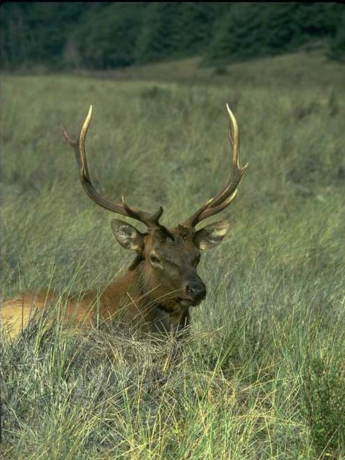
Landscape Ecology
Study Questions are provided for you to help you prepare for an examination on this unit. |
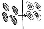
(Corel) Click on thumbnails for enlarged image |
Beginning a course on urban design with a unit on landscape ecology may seem strange. In the past the the development of urban centers were nature sacrifice zones. In the Medieval and Renaissance periods this may have made economic and military sense but today this attitude reduces the quality of life of residents in large metropolitan cities. Learning the spatial needs of wildlife and incorporating them into urban planning can make the contemporary city a joy to live in. Lets begin with some definitions and principles.
Ecology – The interaction of organisms and their environment
Landscape – Miles wide in which local ecosystems and land uses exist
|
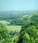
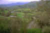
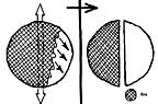
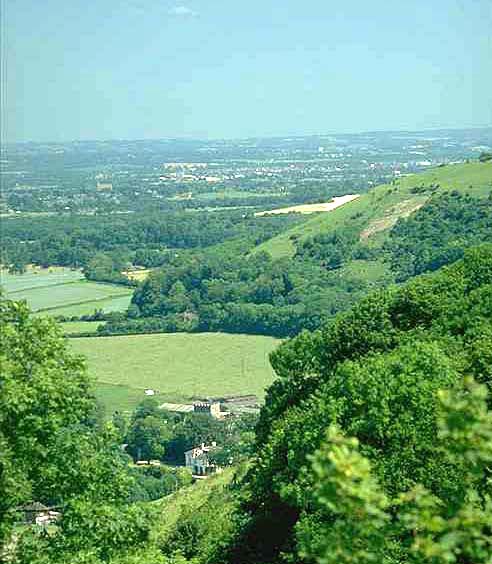
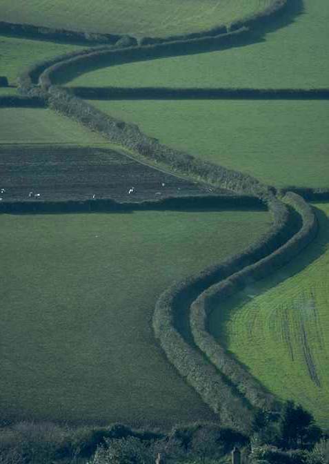
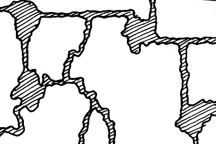
Land Mosaics |
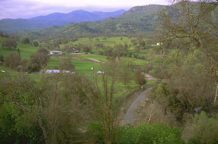
Turin, Italy |
The landscape is really a mosaic of elements arranged spatially. This mosaic as illustrated by the image above is composed of a pattern of patches and corridors within a more or less uniform matrix.
Since this mosaic is spatial there are important implications for land use planning. Urban development also results in a spatial mosaic of nodes and corridors within a matrix of residential housing. |
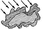
Patches |
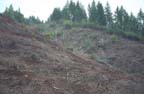 Clear cut slope Clear cut slope |
Patches area landscape units that are naturally occurring or defined by man. Often they are remnants of forest fire or other natural process. Increasingly they are the places left after human modification. Patches are wildlife and environmental resources. Since man has demonstrated a great capacity to destroy natural areas in the acquisition of natural resources or space for development it makes sense that man could configure patches that remain after destruction of areas around them.
|
Patch Differentiation |
(Corel) |
The size, number and location of patches is critical in the provision of habitat for wildlife and plan communities.
|
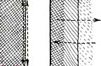
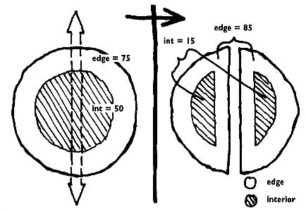
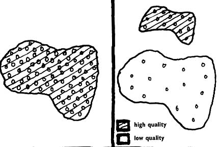
Size and Species |
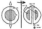
(Dramstead)
|
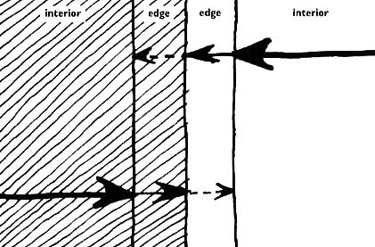
The top image illustrates two kinds of habitat in a patch. The interior of the patch supports some species that the edge of the patch doe not. As patches become smaller the amount of edge habitat increases relative to interior habitat.
Size of patches is related to the chance of extinction and to the amount of habitat diversity within the patch.
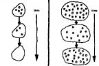
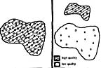
Some organisms require large patches to acquire all the food they need. Examples, of these large home range animals are bear, mountain lion, and elk. Large patches are also necessary when protection of aquifers or stream networks is important. Of course, the quality of the habitat is important. The third diagram illustrates that the same number and diversity of organisms may be present in a small high quality patch as in a large low quality patch.
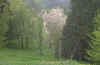
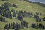
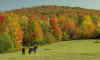
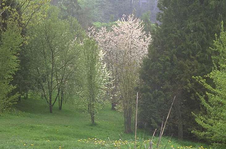
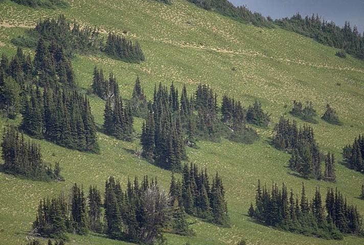
The image below shows small patches of evergreen woodland within a grassland matrix.
(Corel)
|
(Dramstead) |
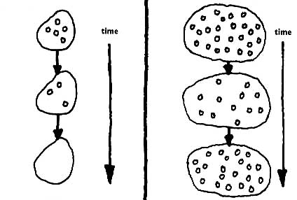
Fractal patches
Many small patches do not offer the same habitat opportunity as a single larger patch, especially for organisms that require interior habitat. |
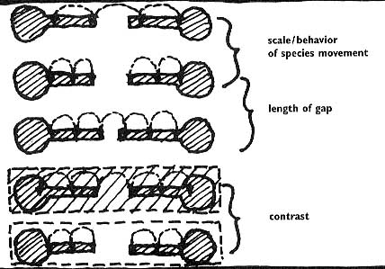
Patch Relationships |
(Corel) |
The spatial relationship of patches determines the degree of isolation of population groups and the threat of extinction. The opportunity for reconinization of habitat is another factor influenced by the relationship of patches to each other. When selecting land areas for conservation, as part of a planned unit development for example, the distance between patches and the shape of the patches can enhance the value of the habitat conserved. |
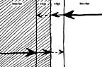
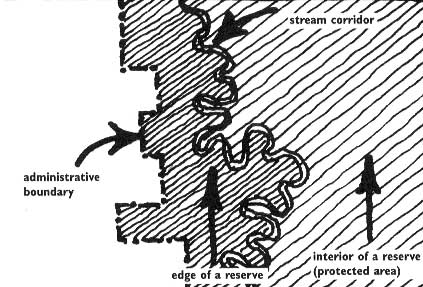
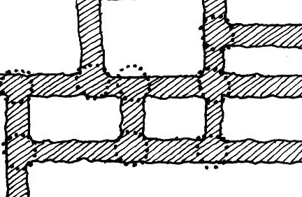
Edges and Boundaries |
(Corel) |
Since patches, corridors and the matrix itself are spatial elements the designer can manipulate the configuration of them to maximize the benefit. |
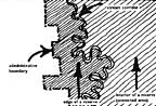 |
Administrative versus ecological edge. A land area boundary determined by jurisdiction or property ownership generally lacks the complexity of an ecologically produced habitat boundary. However, a political boundary can protect habitat by isolating it from public use. |
 |
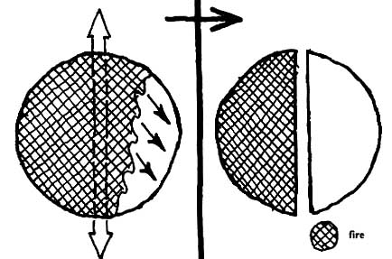
While generally undesirable, gaps in patches can prevent the spread of some kinds of disturbance such as fire. |
 |
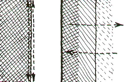
Edge abruptness tends to reduce habitat diversity. |
 |
The patch edge acts as a filter to reduce the negative impact of some kinds of disturbance such as noise or air born pollutants such as pesticides. |
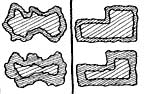 |
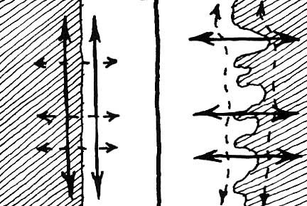
Straight patch edges offer fewer niche habitat opportunity than curved edges |
 |
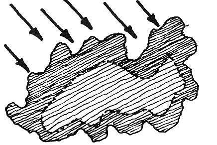
Windward side of patch has a wider edge zone since disturbance is greater from wind and snow. |
(Dramstead)
|
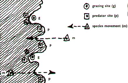
Convoluted edges provids predator and prey sites, as well as migration points. Enlarge this image to study the relationship of locations along the edge.

(Corel) |
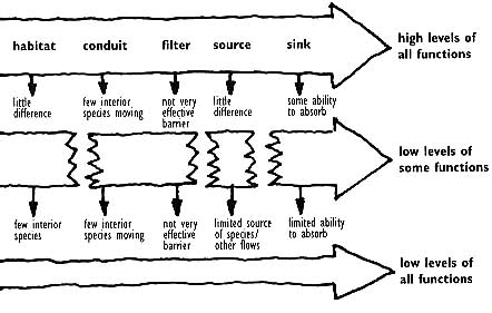
Ecosystem Measurements |

(Corel) |
The measure of healthy and sustainable ecosystems incldes positive physical structure, ecological functions and change. Ecosystems have both vertical and horizontal structure. Generally the greater the variety in vertical stratification and horizontal distribution of plant and animal communities the greater the health and stability of the ecosystem. Resistance to change and resilience after change are measures of ecosystem health. |
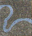
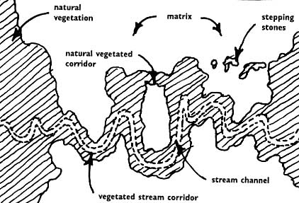
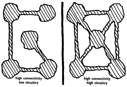
Corridors
Case Studies - Planning Using Landscape Ecology Principles |
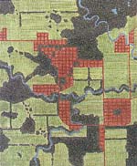 |
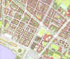
This is a ap of a case study region showing existing farmland, forest, streams, ponds and suburban development. New development proposals will be made for this region and evaluated according to the principles of landscape ecology presented above.
Click to enlarge plan and study the spatial qualities of this landscape
|
Legend |
Pond |
Stream |
Forest |
Cropland |
Subdivision |
|
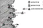
Subdivision Proposal Regional Scale |
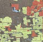 |
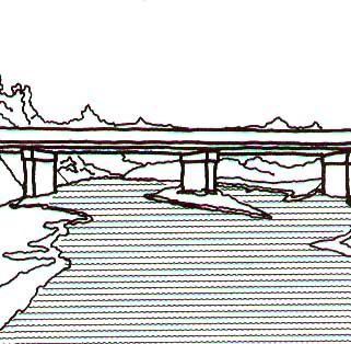
The two plans presented here show alternate locations of a new residential subdivision. This is the worse of the two alternatives based on the following four landscape ecology principles.
1. Specie movement around lake is obstructed.
2. Nutrient enrichment and other pollution of lake
3. Invasion of exotic species into larger undisturbed forest
4. Forest corridor broken by road
Click to enlarge plan
|
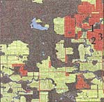 |
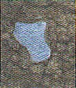
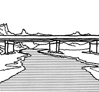
This plan is the better of the two alternatives because of the following characteristics. Note that some loss of habitat is inevitable.
1. River corridor is made narrower but not broken
2. Forested patch size is reduced and the patch is surrounded by urbanization
3. New suburban development is concentrated within the area of existing urbanization
|
Subdivision Proposal Local Scale |
|
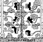
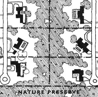
Using the subdivision site selected in the "better" example above, two alternative designs for the lot and building layouts are provided here.
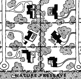
This design for a subdivision follows the traditional American pattern of providing a large front yard. The vegetation is discontinuous or restricted to a narrow corridor.
Click to enlarge plan
|
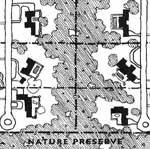 |
In this alternative the residences are held closer to the access road. This creates the opportunity for a wide corridor that connects to the nature preserve.
|
| (Dramstead) |
|
| When you begin doing your design of the urban districts this semester, return to this set of principles and implement them into your design solution. |
|
|
Past Projects of This Studio |
We have contributed to the positive planning and design efforts of many communities during the ten years that this combined studio has been doing outreach work. We have worked in these Idaho communities: Orofino, Riggins, Grangeville, Harrison, Hayden, Sandpoint, Lewiston, Star, Rupert, New Meadows, McCall; these Washington communities - Clarkston ; and these Montana communities - Seeley Lake.
|
|
|
|
|


